It’s been just under a month since our first attempt at the VV. Snow on the passes and rain ruined our plans and “forced” us into an alternative tour — which was also beautiful (read: Falling over is like leaning — just later).
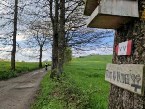
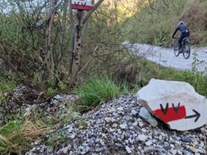
Briefly about the Via Vandelli, VV: It is a historic trade and military route built in the 18th century, connecting Modena with Massa. Strategically routed through the Apennines, it is now preserved as a hiking trail. More details about the fascinating history of the VV can be found at the end of the page.
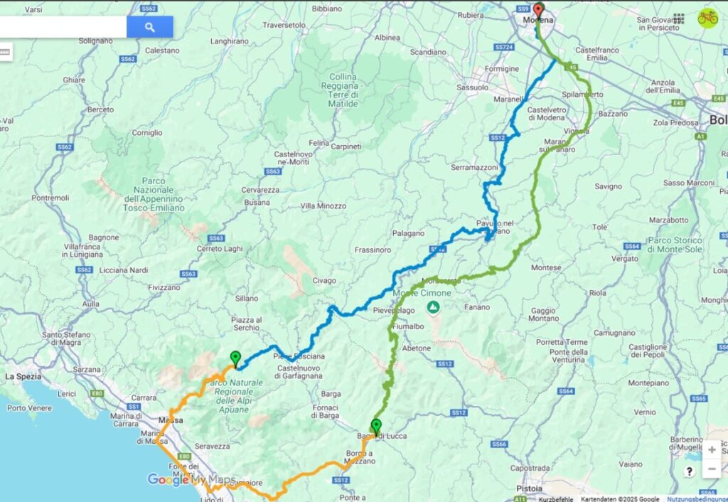
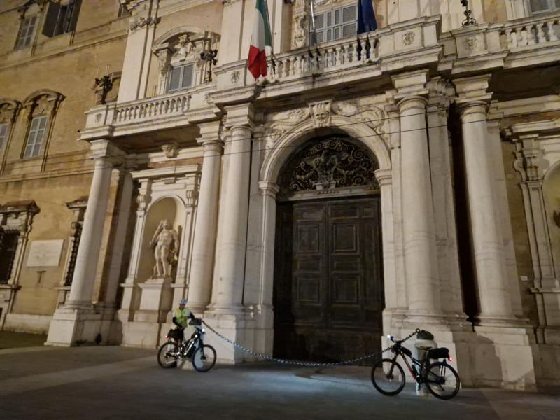
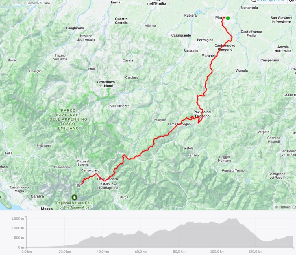
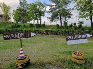
Once again, we’re at the starting point — this time, however, in Modena on the Piazza Ducale.
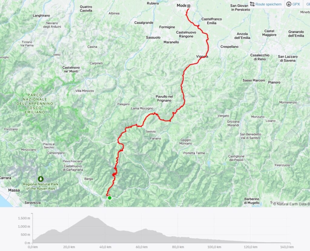
We plan to take three days: one and a half for the Via Vandelli and one and a half for the Antica Via Ducale.
Day1
Video day 1 (2min):
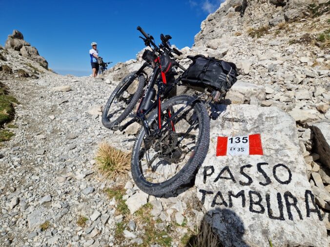
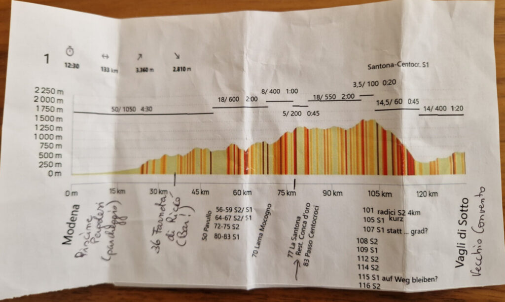
Modena-Passo Radici- Vagli di Sotto
140 km/ 3800 Hm/ moving time: 13h
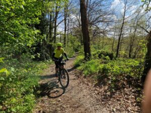
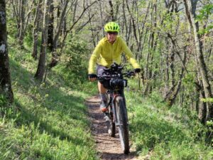
We set off shortly after 5 a.m.—today’s stage will be tough, and we want to reach our booked accommodation in Vagli before nightfall.
We parked the car not far from the starting point: Piscine Pergolesi, Via Divisione Acqui.
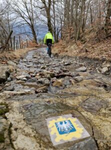
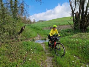
We leave the city on bike paths, then follow a gravel road for several kilometers along the banks of the Torrente Tiepido. After 25 kilometers, we leave the river at Torre Maina, and from there the terrain becomes hilly, with the first very steep climbs.
After 36 km (2.5 hours), it’s time for a second breakfast — luckily, the bar in Farneta di Riccò is open despite the holiday.
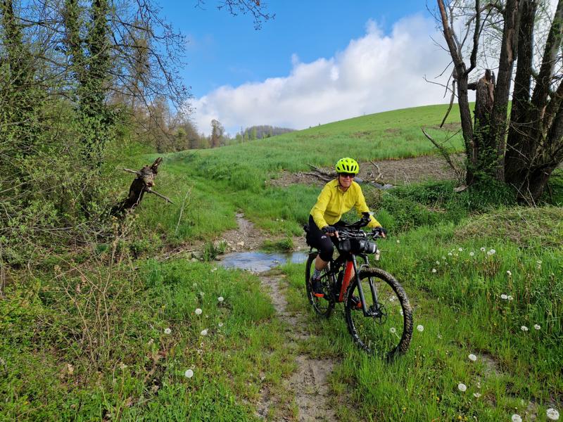
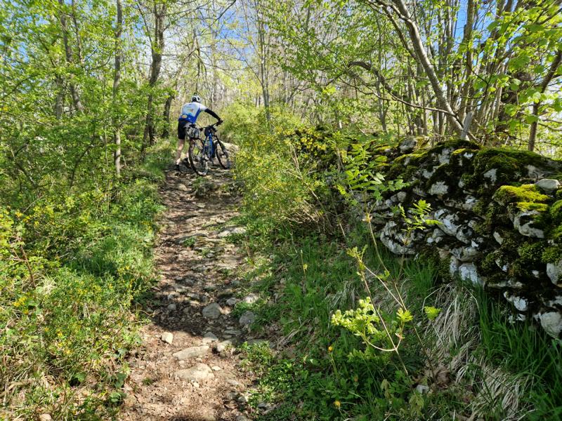
We continue on to Pavullo nel Frignano, alternating between asphalt, gravel, and grassy paths. We had hoped the trail conditions would have improved after a month, but unfortunately, we were proven wrong: many sections on this first day were extremely muddy, and our bikes — and we ourselves — looked accordingly.
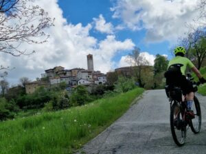
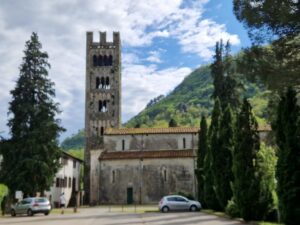
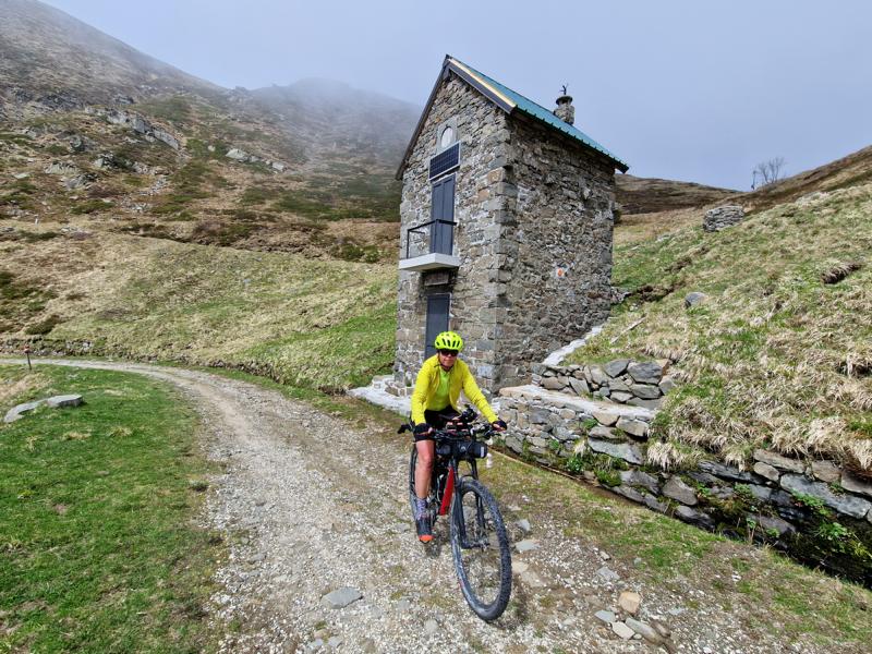
After a short cycle path near the „airport“ of Pavullo, we push our bikes steeply uphill to the Castello di Montecuccolo, an impressive medieval fortress.

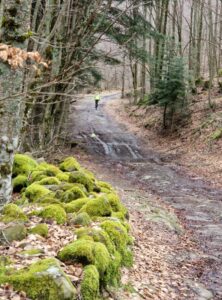
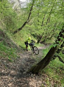
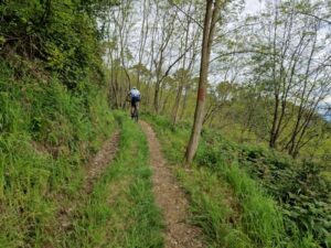
We descend again via single trails; although the hills are generally gentle, the route demands a lot from my riding skills and repeatedly forces me out of the saddle to push the bike for a few meters — not least because of the damp and slippery ground.
Another highlight of this section: the Ponte d’Ercole, also known as the Devil’s Bridge — an impressive natural sandstone arch about 33 meters long, formed over thousands of years through erosion. Its shape is reminiscent of a bridge.
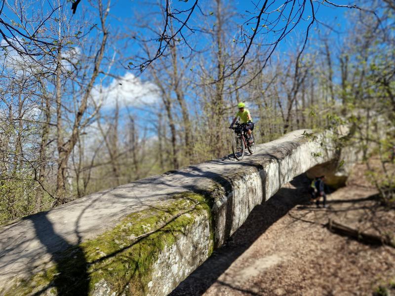
I avoid sticking my head through the hole in the arch, as a well-known story tells of a farmer named Messer Polo, who asked the Devil for help in crossing a river. The Devil agreed, but in return, he demanded the farmer’s soul.
While the Devil was building the bridge during the night, he was distracted by dancing witches and missed the sunrise, allowing the farmer to keep his soul. Since then, according to legend, the Devil punishes anyone who sticks their head through the hole in the arch by decapitating them. (info by IA)
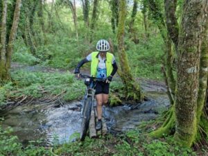
At around km 75, we reach Lama Moccogno. The next section to La Santona (just 7 km) I would choose to do another time on the parallel, low-traffic road. This is because, in addition to a lot of mud and wet, root-filled sections, there is also a part where trees are lying across the path. Getting through is impossible, so we have to haul our bikes up a steep forest slope until we reconnect with the original route.
It’s almost 2 p.m. when we arrive at La Santona. However, we’re still able to enjoy a rustic lunch at the Conca d’Oro restaurant — pasta with wild boar.
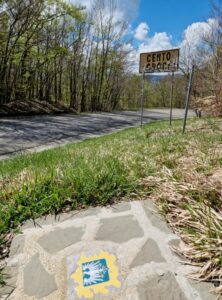
Recharged, we set off for the next climb to Passo Cento Croci. I’m a bit concerned, as I suspect there will be a lot of pushing again. But, apart from the first steep kilometer, the rest of the route is all rideable.
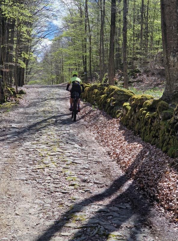
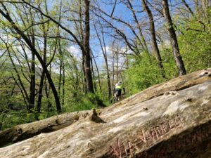
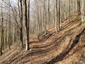
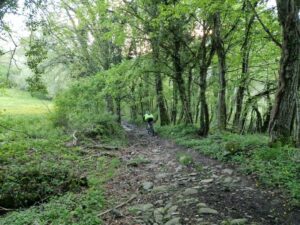
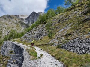
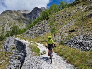
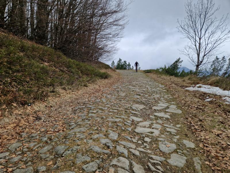
The following 18 kilometers from Passo Centocroci to Passo Radici were familiar to us from our last trip. It’s a beautiful, steady climb and descent through deciduous forests. Sometimes, the path is preserved in its original form, with irregularly laid cobblestones.
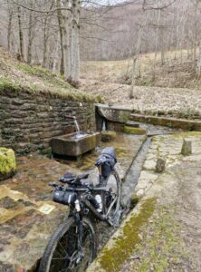
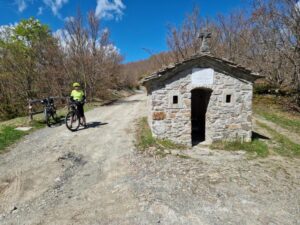
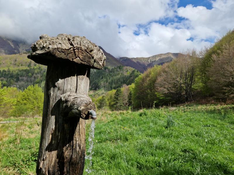
Halfway, we pass an ancient washhouse; a magical place where water flows through several hewn stone basins. I wonder if these stone basins were used for washing or for watering the pack and draft horses. In any case, we use them to clean our bikes as best as we can.
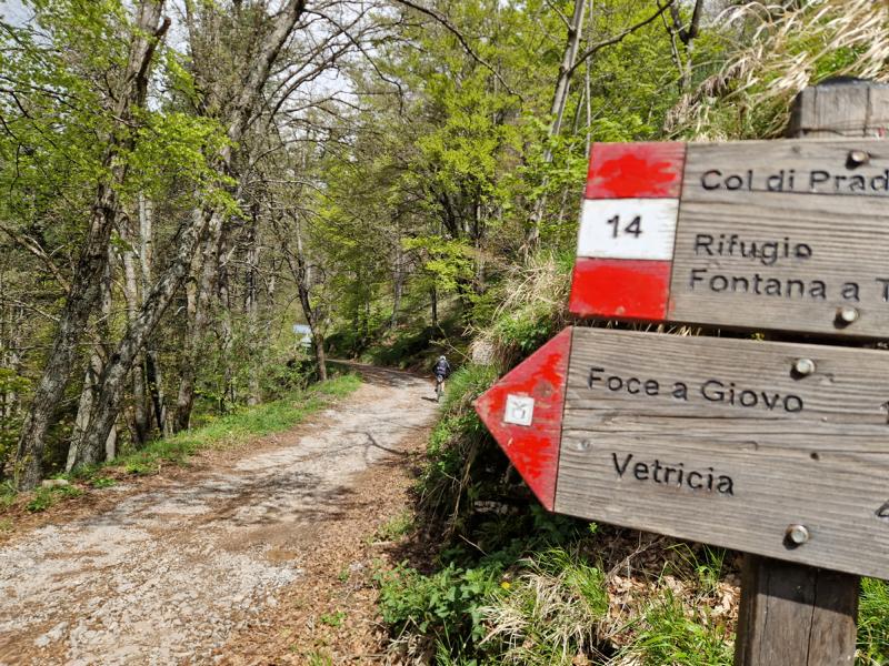
We reach a provincial road that takes us in just a few kilometers to Passo Radici. The pass connects the regions of Emilia-Romagna and Tuscany. Here, we avoid the original route, which has a steep pushing section. From the pass, we cycle along a single trail with minimal ascent to San Pellegrino in Alpe.
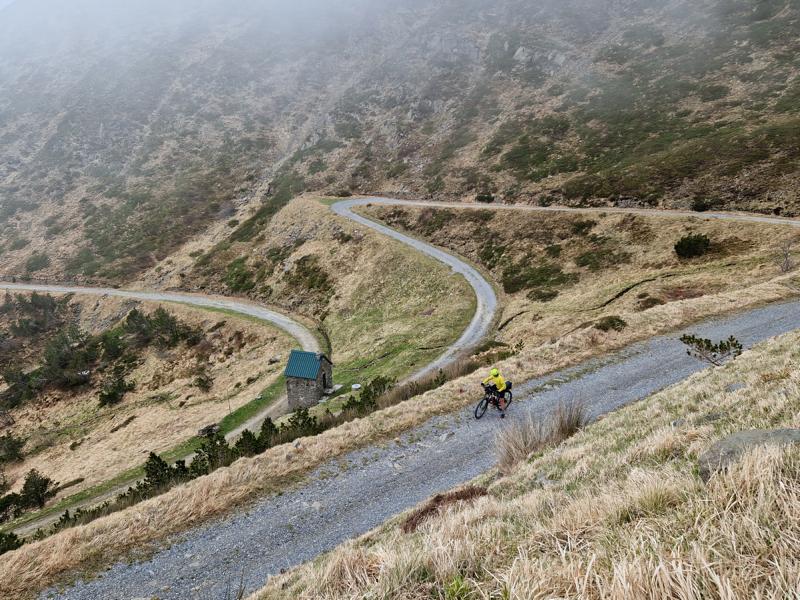
Now, we allow ourselves to take the road, which leads very steeply down in many curves to Castelnuovo di Garfagnana. The VV hikers take a different route here, which leads very steeply downhill near the road (often difficulty S2).
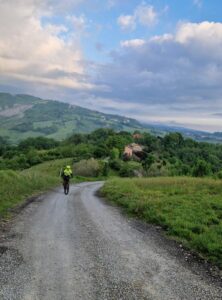
Only 15 kilometers separate us from our next accommodation. We’re still on schedule, and the sun is slowly setting. We ride along the original route, passing the shores of Lake Pontecosi, which, however, is dry due to work being carried out by the energy company Enel. So, we cycle along the Serchio River with a pleasant series of ups and downs.
Here we encounter another highlight:
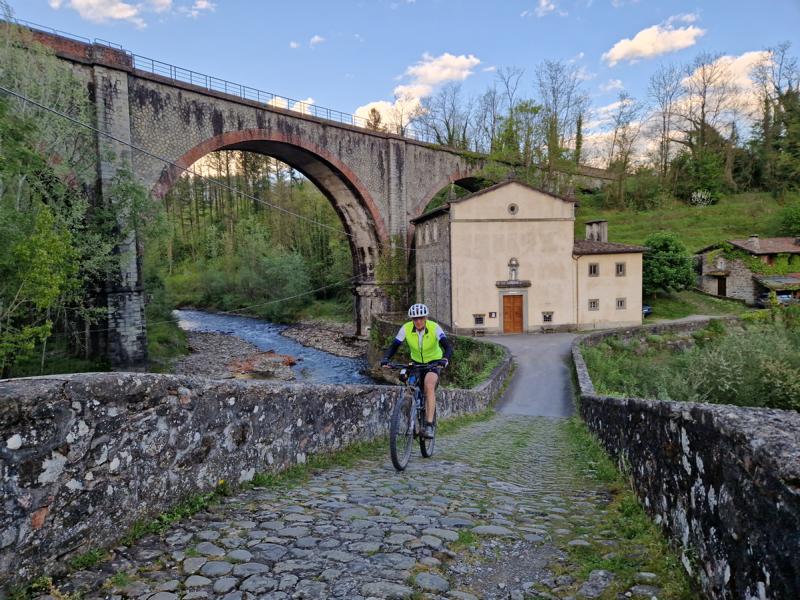
The Ponte della Madonna di Pontecosi. The bridge dates back to Roman times and has the typical humpback shape. Its name, ‘Pontecausi,’ gave the nearby village of „Pontecosi“ its name.
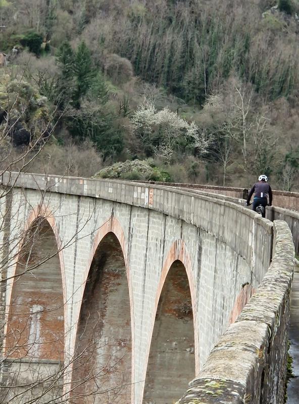
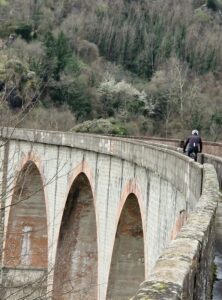
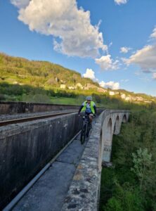
The next highlight comes a few kilometers later: crossing the valley over the railway bridge, Ponte di Villetta, on the narrow footpath along the tracks. One should be free of vertigo, as the drop to the Serchio River is 54 meters in the middle of the bridge, and the railing is not very high.
The Ponte di Villetta, this 408-meter-long railway bridge on the Aulla–Lucca line with its 13 arches, was built nearly a hundred years ago, destroyed during World War II, and rebuilt in the 1950s. (Information from ChatGPT/OpenAI, 01.04.2025)
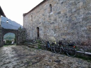
We then cycle into the narrow valley toward Lago di Vaglia, a reservoir, at the end of which lies Vaglia Sotto. In the first part, we follow the original route, then switch to the road. As dusk falls, we continue along the shores of Lago di Vagli. Shortly afterward, we reach our B&B, the “Vecchio Convento,” next to the small Romanesque church. It’s a very lovely place, and if someone doesn’t mind shared bathrooms, I would highly recommend it. The B&B has only recently opened, and the facility will be expanded in the near future.
The “Boss,” Valentina, is very kind and accommodating. We have a late dinner at the Ristorante Radicchi, which is located just across the street. It serves guests until 10 p.m., and you can also shop at the integrated mini shop.
A detailed description of the original Via Vandelli and an interesting overview of its history can be found on the DAV website: „Mountain biking across the Apennines.“ (in german)
History: The Via Vandelli is a historic trade and military road that was built in the 18th century to connect the cities of Modena and Massa in northern Italy. Its name comes from Domenico Vandelli, a geographer and engineer who planned the construction under the rule of Francesco III d’Este, Duke of Modena.
History of the Via Vandelli’s Creation
In the 18th century, the Duchy of Modena needed direct access to the sea to facilitate trade and become economically more independent. Francesco III d’Este wanted to create a strategic route connecting his duchy with the port of Massa.
Francesco III d’Este sought a road that passed only through his own territory to avoid paying tolls to other states. Being dependent on trade routes controlled by neighboring states would make the duke vulnerable to extortion. As a result, he was forced to choose a route that crossed the Apennines.
Construction began in 1738 and took several years to complete. The route passed through the Apennines and the Apuan Alps, which made the work particularly challenging. The road was built with switchbacks to ease steep sections. Stone slabs and bridges were partially installed to make the path more stable. Despite innovative construction techniques, the road was often difficult for carts and goods to travel on. (Source: ChatGPT/OpenAI, 01.04.2025)


Day 2
Video day 2
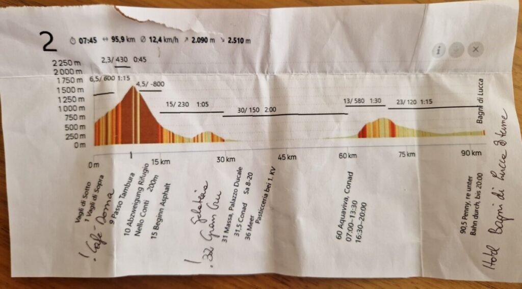
Vagli di Sotto – Massa – Bagni di Lucca
95 km/ 2000 Hm/ moving time 9h
Around 7 a.m., after a very light breakfast at Il Vecchio Convento (I wished it had been a bit more generous), we set off.
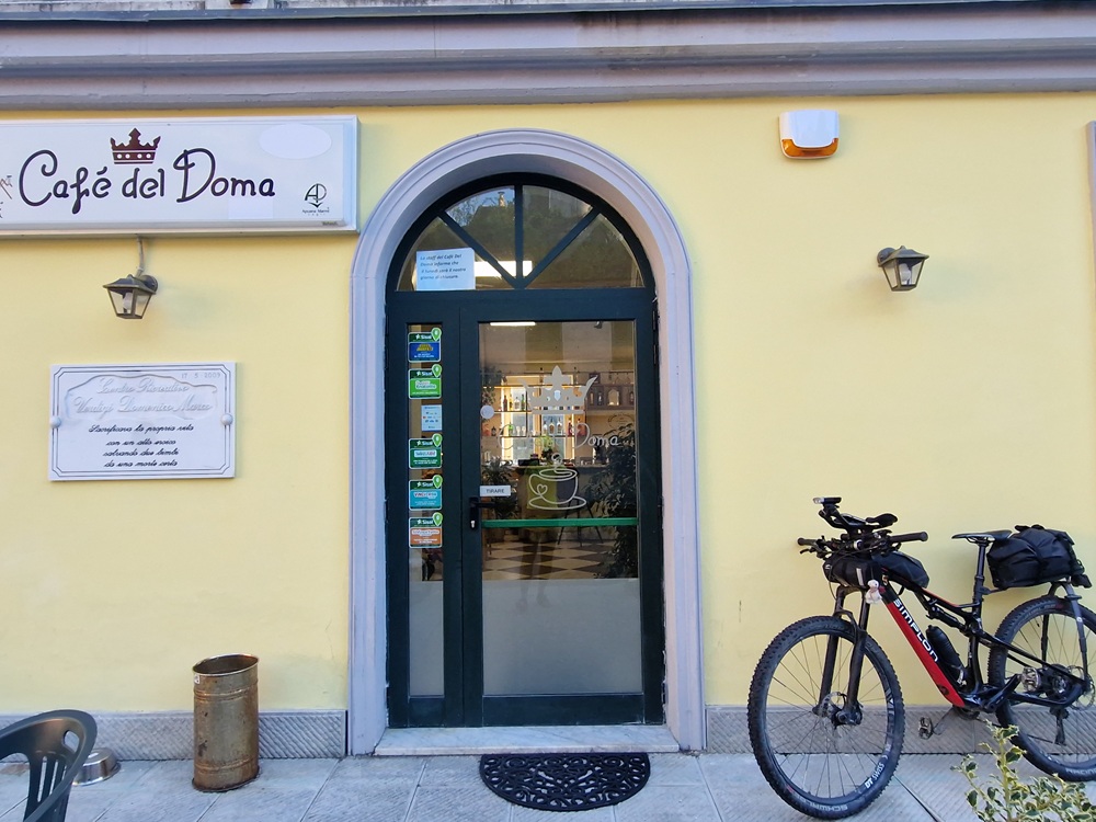
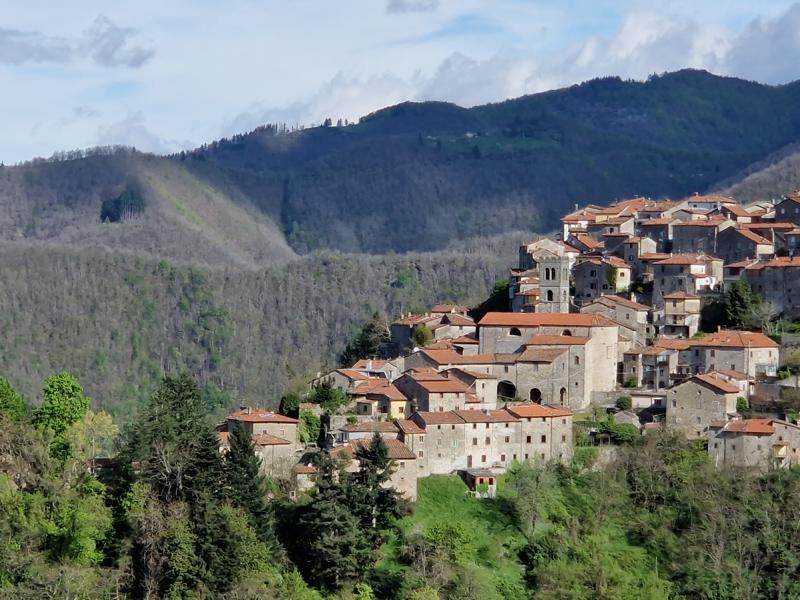
First destination: Passo Tambura. It gets serious right away—meaning, very steep. On asphalt, we reach Vagli di Sopra in just one kilometer. It’s beautifully perched high on the hillside. And tadaaaa! The Caffè del Doma is open. The server tells me they open early every day, only an hour later on Sundays and holidays.

The small shop that Google Maps shows in the village, however, no longer exists.
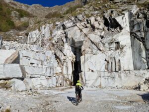
We now continue into a valley where marble is extracted in several locations. It’s Saturday today—so will it be quiet, with no trucks around? Nope, it won’t. You can already hear construction noise from up high.
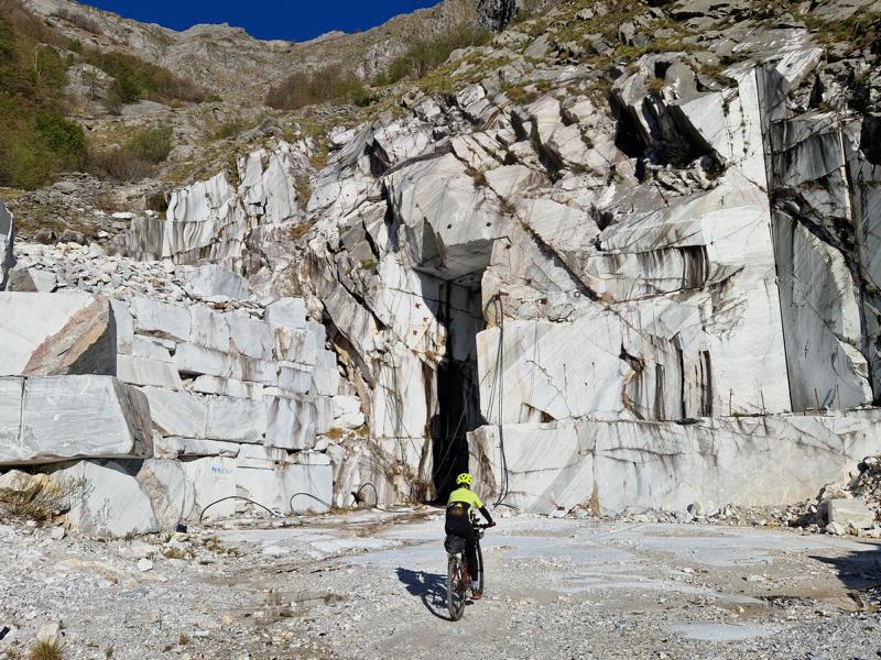
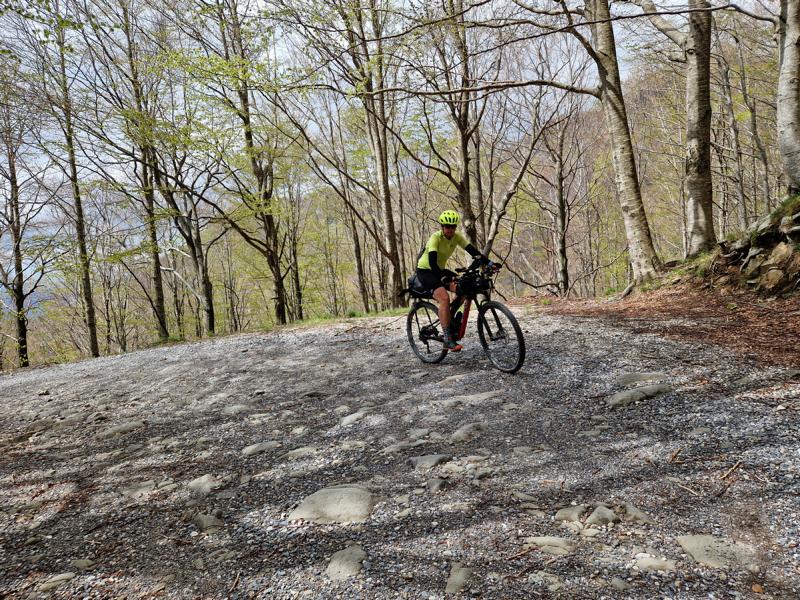
We start out on tarmac, then continue climbing on a gravel road that’s fairly rideable. The first 6 kilometers involve a 600-meter elevation gain and are supposedly rideable. And they are—mostly. But repeatedly the incline is so steep I have to get off and push for a few meters.
Then it’s no longer rideable. The last marble quarry fades behind us and the gravel road narrows to a trail. It’s very bumpy, with large rocks in the way, so pushing the bike is tough—I end up lifting it over some obstacles. My goodness, if this continues for 2.5 kilometers…
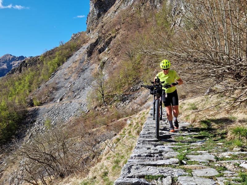
Thankfully, after the first curve, it gets better and I can push the bike more easily. The path is often still paved with the original stone surface. The 450 meters of elevation only become tough again near the pass, where the final stretch is steeper and I have to carry the bike for a few short sections.
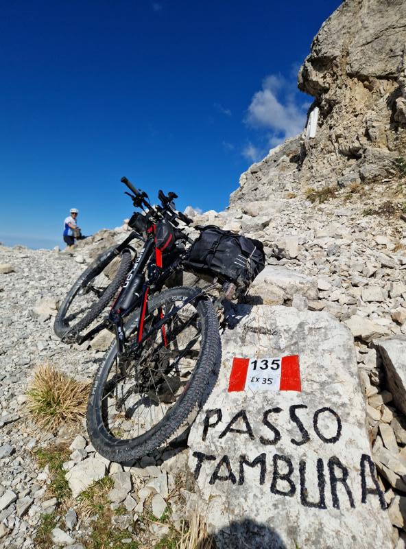
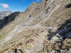
Finally, at the top (just over 3 hours since departure), we’re rewarded with a dreamlike view over the mountain peaks and, in the distance, the sea. I look down expectantly at the path ahead. Is it possible I’ll have to push the bike for 6 kilometers downhill? Yes, it is. The path doesn’t look that difficult, but it’s often covered in scree or paved with very uneven stones—and on the valley side, the drop is extremely steep. A fall would be disastrous.
Pushing works fine, though, except for two spots where you have to lift the bike over rocky steps.

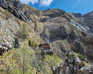
After a kilometer, a wonderful surprise: a small meadow. We park the bikes and walk the 200 meters over to Rifugio Nello Conti. It’s absolutely worth those 5 minutes—the location is spectacular. There are drinks, and even food. The hut is run by a young couple.
They manage the hut with a lot of heart and muscle power, because with no cable car and no road, everything has to be carried up on their backs.
Then we head back downhill—pushing, with some short stretches of riding, at least for me. If someone’s more technically skilled, they might manage more in the saddle.
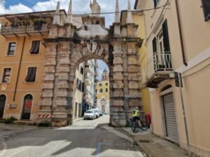
After 2 hours (excluding the hut break), we hit tarmac again. We rush downhill towards Massa. After the obligatory finish-line photo at the Piazza Ducale, we continue toward the sea. Right before reaching it, an emergency stop—I’d almost passed the ice cream shop! And what a shop! Gelateria Gran Cru. I rarely get ice cream that delicious.

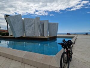
A short photo stop at the beach in Marina di Massa with the beautiful „Le Vele“ monument in the frame. “Le Vele” was designed by Italian sculptor Pino Castagna and is made entirely from white Carrara marble, a material known for its purity and quality. The sculpture represents stylized sails, evoking the maritime heritage of the region. It’s installed on a platform surrounded by water, giving the impression of sails floating on the sea. Very beautiful!
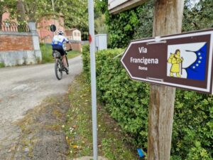
Then we ride along the bike path next to the sea. Unlike the mountains, it’s very busy here, so you can’t just race along without a care. After 10 kilometers, we head back inland. The route becomes more varied, along small country roads, parts of the Via Francigena, and even a narrow trail along a stream embankment.
The next and final climb looks minor on the elevation profile compared to the Passo Tambura, but it’s still a 600-meter ascent. A more trafficked road annoys me a bit, but soon we turn left, it gets very steep again, and then we’re back on rough terrain—tough going. Eventually, we reach the top of the „colle“ and after the Passo Lucese, we descend into the valley almost entirely traffic-free, then follow the Serchio River for a while (which we already knew from our ride 4 weeks earlier).

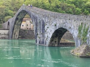
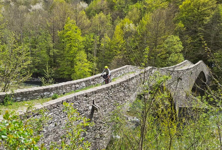
At Borgo a Mozzano, we hit a highlight you just can’t pass by: the Ponte della Maddalena, also known as the Devil’s Bridge (Ponte del Diavolo). It’s a stunning medieval stone arch bridge over the Serchio River. It was likely built in the 11th century under the rule of Countess Matilda of Tuscany, serving as an important crossing on the Via Francigena, the famous medieval pilgrimage route to Rome. The bridge is about 95 meters long and has five arches. Its asymmetric design with the prominent main arch gives it a unique look.
(ChatGPT, April 30, 2025)
That said, I really can’t imagine horse-drawn carts ever crossing that bridge—the cobbled deck is so steep!
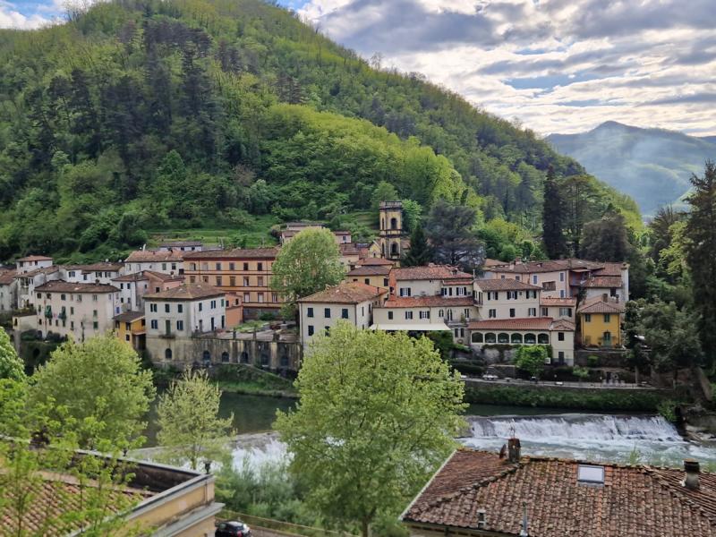
Then, unfortunately, we have to ride 3 kilometers on a fairly busy road, but it’s a two-lane road, so there’s space for everyone. And in no time, we reach Bagni di Lucca. Our Hotel & Terme Bagni di Lucca is located a bit up on the hillside. Bad luck for us: the restaurant is closed, so we have to walk down into town in our cycling shoes.
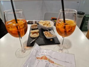
But there we’re rewarded with a delicious dinner at the interesting Cavalier Bruno restaurant—service and kitchen run by one man alone. You have to be lucky to get one of the few tables. Before that, we highly recommend the Bar Italia next door for an aperitif. They serve tasty snacks, and you might even find some light food options there too.


Day 3
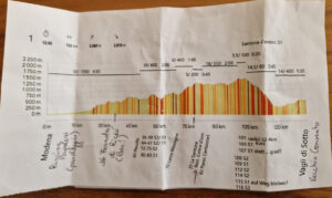
Bagni di Luca – Foce a Giovo (Via Ducale) – Modena
140 km/ 2500 Hm/ moving time 10h
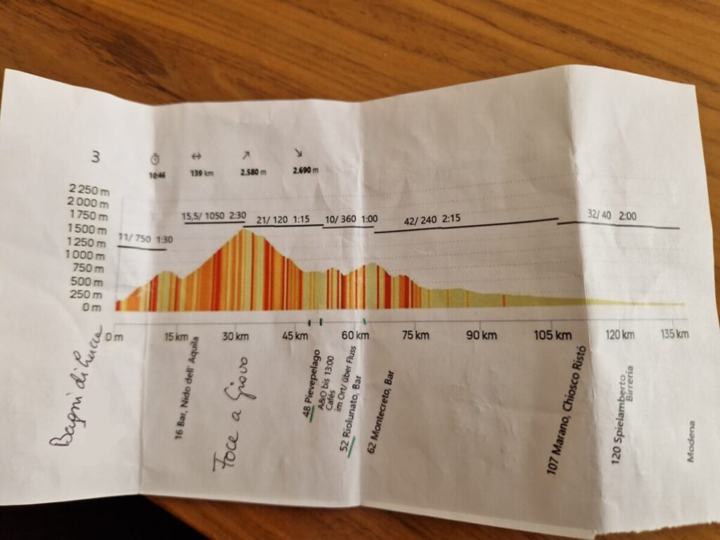
Today we have a demanding stage ahead—not because it’s technically difficult, but because of its length and the elevation gain. In itself, nothing too unusual, but we also have a three-hour car drive afterward (probably more exhausting than cycling 😊).
Right out of the hotel, the route gets serious—meaning uphill. The narrow paved road winds beautifully through scrub forests, gaining 750 meters in elevation over 11 kilometers. At the lovely hilltop village of Montefegatesi, we unfortunately lose some of the hard-won altitude during a descent.
Then comes today’s bogeyman: the climb to the Foce a Giovo, 16 km and over 1000 meters of elevation gain. The Foce a Giovo (also known as Passo al Giovo) is, at 1,674 m, the highest passable road in the Tuscan-Emilian Apennines. It connects the provinces of Lucca (Tuscany) and Modena (Emilia-Romagna).
The Tuscan side is paved up to Rifugio Casentini (1,250 m), after which a gravel road leads to the pass. The Emilian side is completely unpaved and closed to vehicle traffic.
The climb isn’t as tough as feared. The gradient is always moderate, and while the surface after the rifugio is gravel or cobbled, it remains rideable. And from Bagni di Lucca onwards, there is virtually no traffic.
The road over the Foce a Giovo was built in the early 19th century as the Strada dei Duchi or Via Ducale. It was the result of an agreement between Maria Luisa of Bourbon, Duchess of Lucca, and Francesco IV of Modena, aiming to establish a direct route between Lucca and Modena that avoided the tolls of the Grand Duchy of Tuscany. (ChatGPT, 30.04.25)
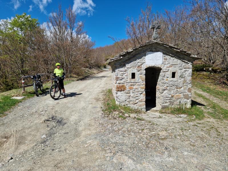
The final three switchbacks after Casello del Guardafili are a popular photo spot. I wonder what a „Guardafili“ is—someone who “watches wires”? A quick check with AI reveals: the small high house of the Guardafili is a former service building for the power line, located just before the pass on the Tuscan side.
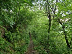
On the other side of the pass, the Antica Via Ducale becomes more difficult to ride. The uneven cobblestones rattle us cyclists quite a bit, and in some places there’s still snow on the trail.
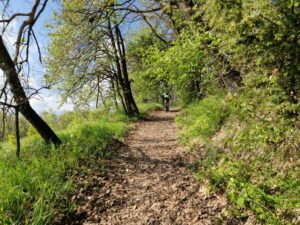
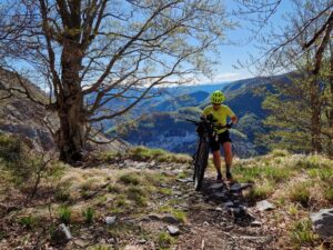
Still, the landscape is beautiful as we ride through open mountain forests with views of the Emilian hills.
At kilometer 40, due to time constraints, we decide to continue on the road and cancel the planned off-road section.
Just before Riolunato is the Ponte della Luna, a historic stone bridge that spans the Torrente Scoltenna. This well-preserved cobbled bridge is accessible on foot. The cycle path from Pievepelago was closed due to a rockfall, but we simply climbed over the barrier. Just before the bridge, only a damaged wooden railing was visible.
One more short climb takes us to the village of Montecreto, and then it’s mostly downhill.
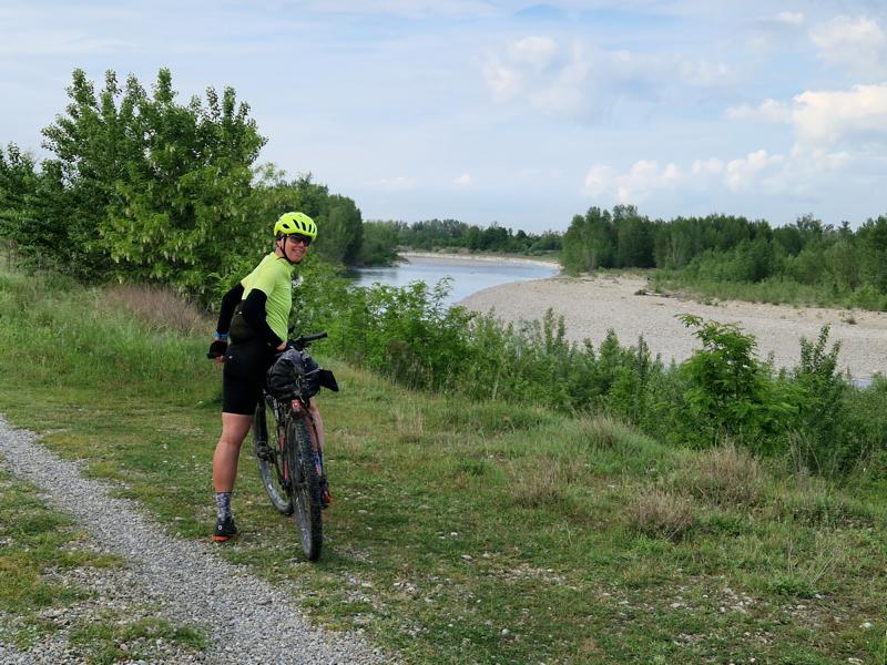
At kilometer 75, we follow the Torrente Coltenna, which flows into the Panaro River a few kilometers later. We will follow the Panaro almost all the way to Modena.
At the confluence, we try the original Via Ducale along the hillside again, but as progress is slower than expected, we switch to the road at kilometer 86. However, this road is quite busy, so I’m relieved when, after about 15 kilometers, we can turn onto the river bike path. Before that, we make a much-needed stop at Bar Puccini Di Guo Hai (before Marano) for a snack.
The bike path along the Panaro leads almost all the way to Modena and is mostly on natural surfaces or gravel.
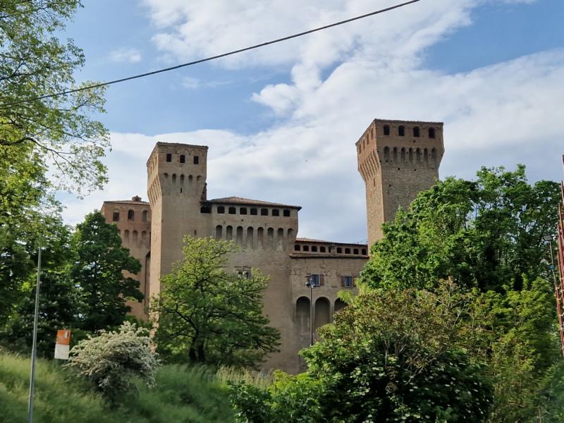
A highlight is the town of Spilamberto with its medieval Castello.
The Castello di Spilamberto, also known as Rocca Rangoni, is a historic fortress. It was built in the 14th century by the city of Modena as a watchtower and was part of a defensive system guarding the border with Bologna and the Panaro River.
After Spilamberto, our track switches to the other side of the river. It becomes quite remote and overgrown in places—no real bike path here anymore, but the trail seems to be regularly used by hikers. Whether the bike path continues on the left (downstream) side of the river… you’d have to give it a try.
At San Donnino, we re-enter inhabited areas and soon reconnect with the bike path that had led us out of Modena two days earlier.
A few more kilometers, and we’ve completed the Via Vandelli & Via Ducale loop.