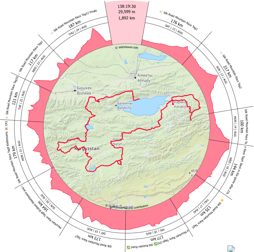
1892 km with 29599 meters of elevation gain through Kyrgyzstan Since its first edition in 2018, I have dreamt of participating in this event.
Report from Christian Biehl.
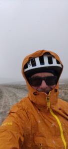
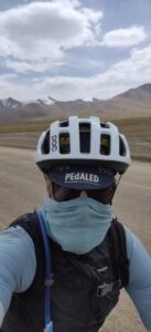
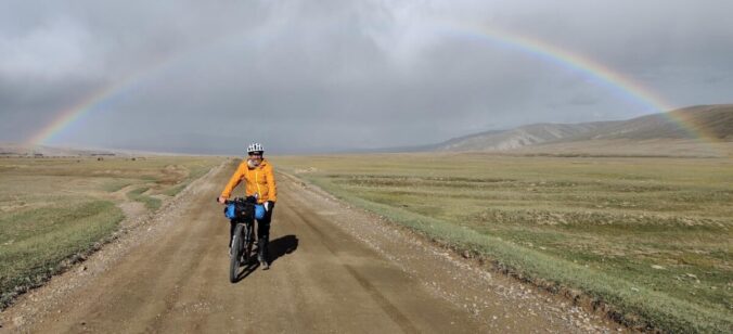
The race primarily takes place on unpaved roads, through remote areas, high challenging mountain passes, plateaus, ghost towns, along large mountain lakes, and along the borders of Kazakhstan and China. Temperature variations range from -10°C to +40°C. Long stretches with no access to food supplies. Typically, only 50-60% of the participants manage to reach the finisher’s party within the 14-day timeframe. It sounds like an enticing adventure.
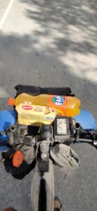
My equipment: See here
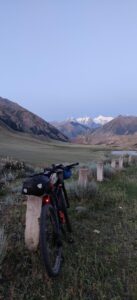
Acclimatization: A week before the race, my wife and I stayed in Karakol, a popular destination for trekkers. To acclimatize to the altitude (as the first two race days involve crossing passes at 3400 m and 3900 m), I decided to go on a 3-day hike to the mountain lake Ala Kul. Spending 2 nights at 3000 m and crossing a pass at 3900 m took a toll on my body.Two days before the race, we returned, I assembled my bike, and met many fellow participants. The tension in the air was palpable. There were 144 riders from 29 countries, spanning all age groups. There were even some riders in their 60s participating.

Day 1: The Usual Initial Rush
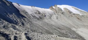
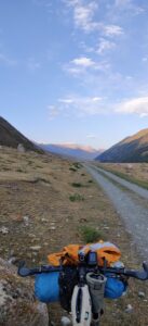
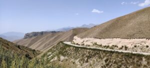
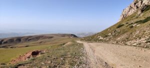
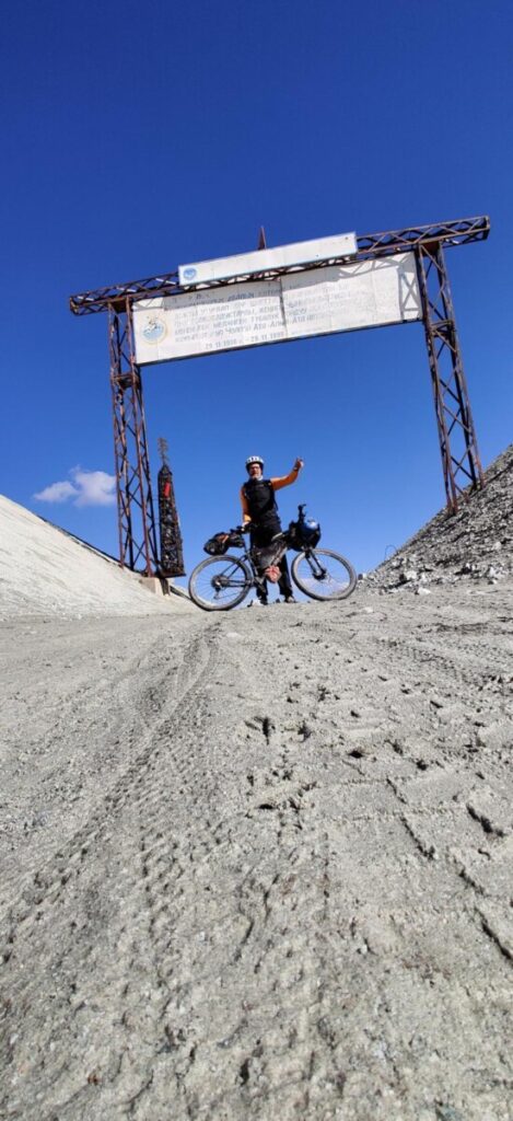
Start: August 12th, 09:00 The first 40 km were neutralized. After that, the field quickly spread out. As always, everyone was going too fast, trying to minimize breaks. In a shop, the last settlement for the next 200 km, bottles and bags were filled again. Along the Kazakh border, the route led through a picturesque valley to the first pass (3400 m). Beyond the pass, it was single trails towards Enilchek, an abandoned mining town near the Chinese border.
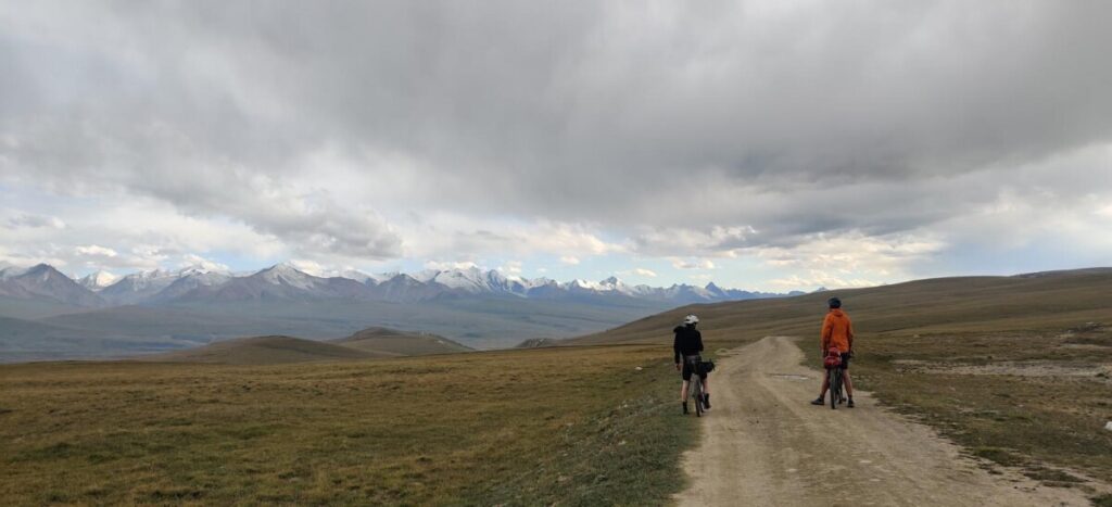
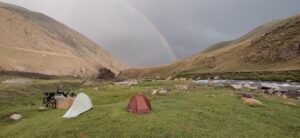
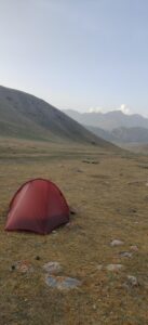
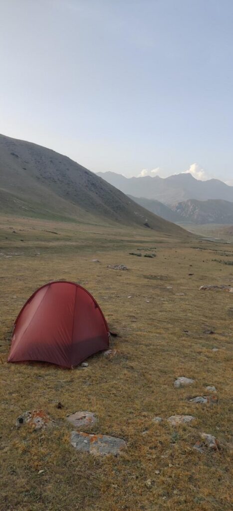
Around 8:15 PM, in the emerging twilight, I decided to set up my campsite just before crossing a river, not pushing all the way to CP1 (another 44 km). I was tired and hungry and didn’t want to overdo it on the very first day. Distance covered: 176 km with 2300 meters of elevation gain.
Day 2: First Checkpoint and High Pass
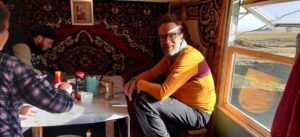
Already at 04:20, I was back on my bike, or rather, pushing it barefoot through a river. Through a spectacular gorge, the route led me first for 13 km on a dirt road before the turn towards Enilchek came. An asphalt road descended 300 meters to CP1. Some riders who were ahead of me were coming back my way. I reached CP1, located in an abandoned shack, around 07:00. I had scrambled eggs and porridge for breakfast, dried my tent in the meantime, refilled my water bladder, and then continued.
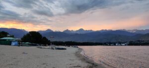
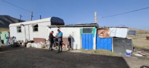
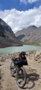
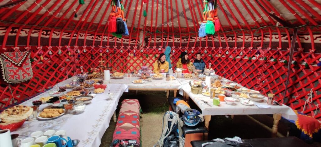
Around 14:00, after a 62 km climb, I stood atop the 3800 m high pass. The subsequent descent to Lake Yssykul at 1700 m was tremendous. Unfortunately, there was a headwind in the valley. Along the lake, it was hot and very dusty. Every passing car left a trail of dust. My Merino Buff was worth its weight in gold here, constantly moving up and down. At 20:00, I reached a place where, according to Google Maps, there should be accommodation. Unfortunately, such places are not easily identifiable in Kyrgyzstan. Together with Rob, a 62-year-old professor from NY, we knocked on the presumed house. Surprisingly, we were able to share a yurt. There was also a shower, and the host treated us to pastries, salad, and tea. Distance covered: 216 km with 2137 meters of elevation gain.
Day 3: Majestic Landscape and Bike Trouble
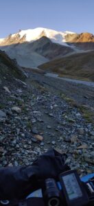
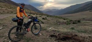
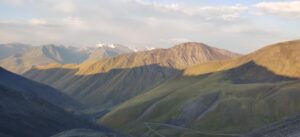
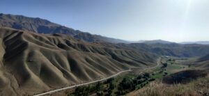
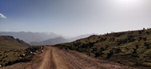
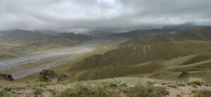
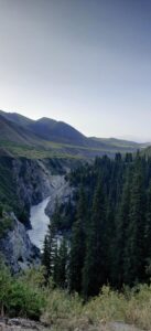
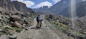
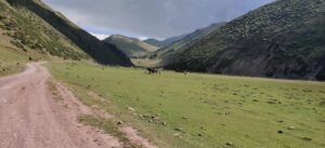
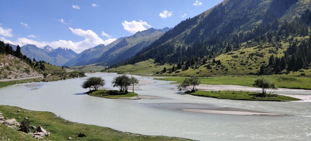
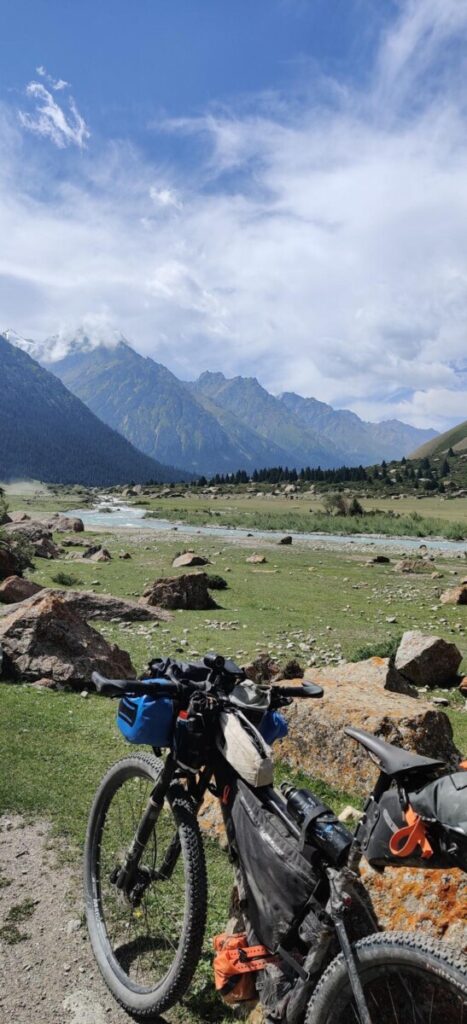
I was back on my bike at 05:45. The next 37 km mostly went along a busy road to Saruu. From here, I entered the Djuuku Valley. My odometer showed 60 km with 2121 meters of elevation gain. This valley was one of the most beautiful parts of the entire race.
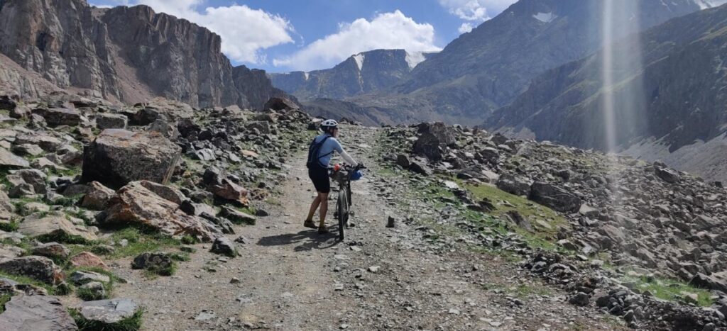
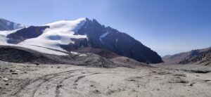
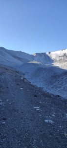
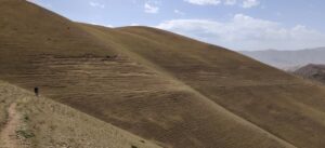
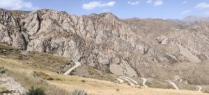
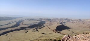
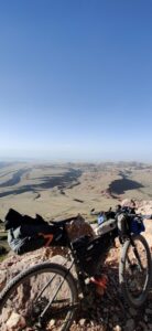
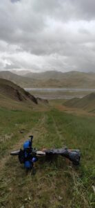
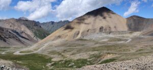
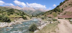
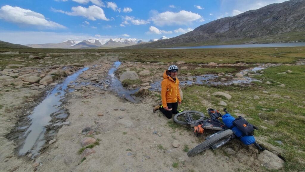
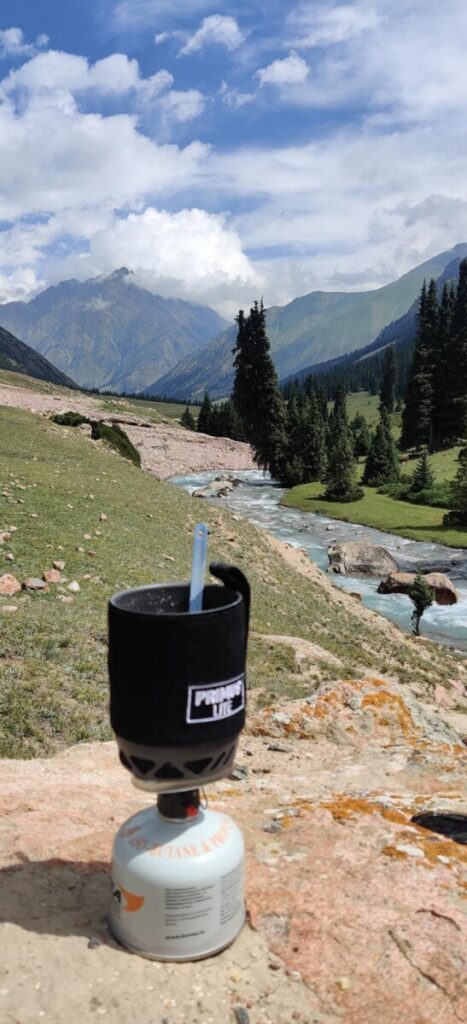
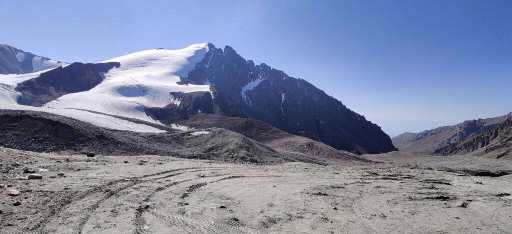
It was mostly rideable until 7 km before the Arabel Plateau. There were numerous river crossings, most of which I managed without dismounting. In between, I cooked myself lunch (a portable meal from Jentschura).The last stretch was a brutal ordeal, pushing and carrying my bike over rocks, up to the plateau at 3700 m altitude. I finally made it to the top around 16:00.
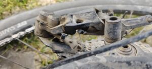
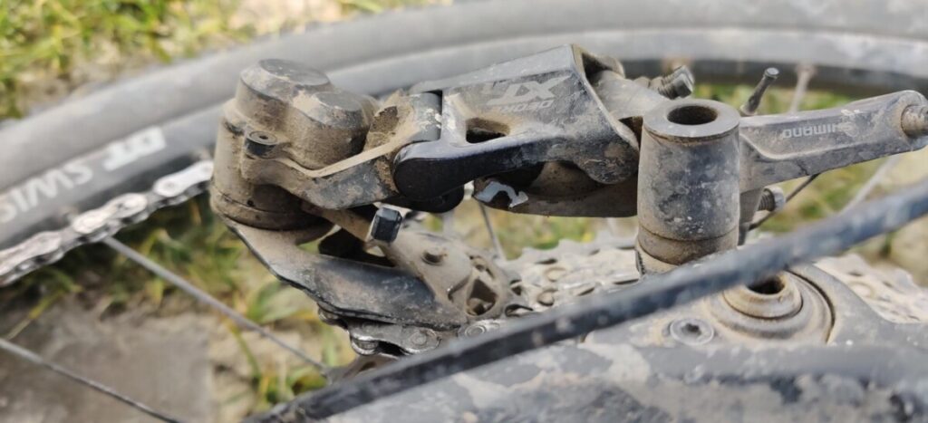
The sun was shining brightly, but there was a cold wind, and the air temperature had dropped to just 3°C.In my euphoria, I momentarily lost focus and seemingly crashed my derailleur into a rock, which promptly broke. Attempting to convert the bike to single-speed worked only moderately well. To make matters worse, shortly afterward, my front wheel got stuck in a stream, and I fell into the wet mud on my left side.
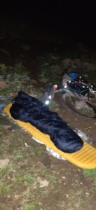
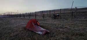
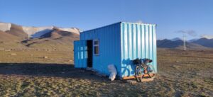
An hour before sunset at this altitude was far from enjoyable. Just as I was about to set up my tent, I spotted a blue container. The door was open, and inside were 2 bunk beds. It was a godsend. Later, a Russian couple and a Kyrgyz joined us. The night was freezing cold. By morning, my wet gloves and shoes were stiff from the cold. Distance covered: 100 km with 2530 meters of elevation gain.
Day 4: Forced Pause
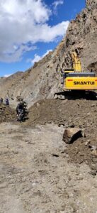
My bike can only be repaired in Bishkek, which is about 7 hours away by car. Additionally, I find myself on a remote plateau where there is supposed to be a Canadian mine. It’s 40 km down to the valley, at least 17 km of which are impassable with my broken derailleur. Feeling disgruntled and desperate, I make my way to the road. I’ve barely been walking for 5 minutes when a jeep with 3 locals pulls over. „What’s your problem?“ I explain, „My bike is broken.“

They ask, „Shall we take you?“It turns out, they are mine workers who are now on a 2-week leave and heading to Bishkek! They drop me off directly at the bicycle shop around 16:00. The derailleur and chain are fixed within 30 minutes. Returning directly today wouldn’t make sense. Firstly, probably no one would drive me back up there at night, and secondly, it would be risky to arrive there after a total of 14 hours of travel in minus 10°C at midnight. I find accommodation, wash my clothes, fill my stomach, and arrange for a taxi at 04:00 the next morning.
Day 5: Back on the Trail
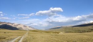
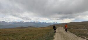
After a 7-hour car ride, I’m back on the plateau after a 27-hour break, overjoyed to resume my journey. According to the tracker, I’m around the 120th position, just ahead of the virtual snail. I struggle against the wind for 20 km across the plateau, first along the dusty road, and eventually on single trails. Hail comes down intermittently, and the temperature drops to 3°C. I descend into the Jyluu Suu Valley through steep switchbacks.
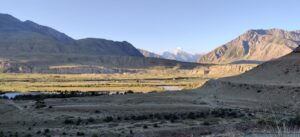
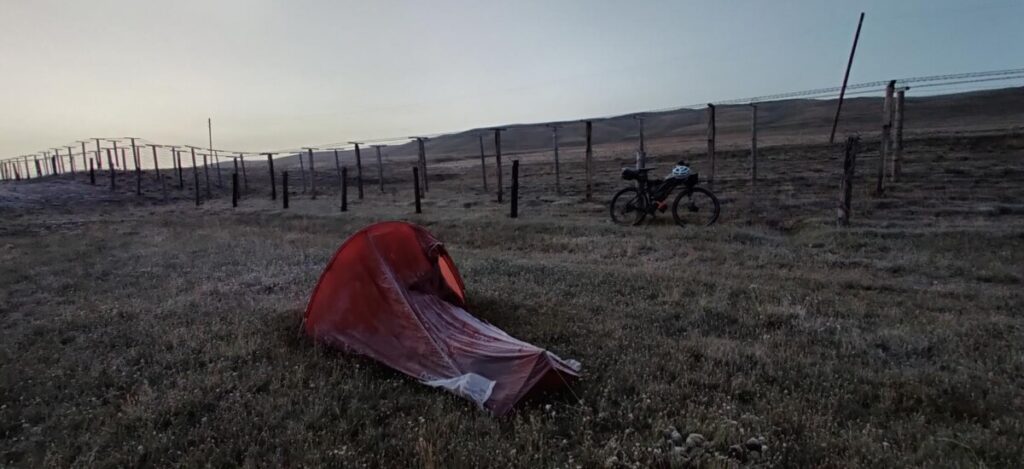
The next 100 km are a gentle downhill ride through lush meadows, crossing numerous streams, flanked by majestic mountains—a dreamlike setting. In 6 hours, I encounter only a handful of people but hundreds of horses, sheep, cows, yaks, and marmots. Towards evening, the terrain becomes slightly hilly again. Many times I have to push my bike. Eventually, the path narrows into a canyon. It’s only around midnight when I finally find a spot to pitch my tent.Distance covered: 144 km with 1474 meters of elevation gain.

Day 6: Naryn Sandstorm
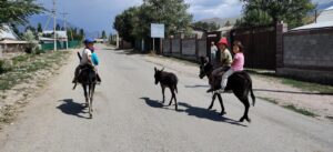
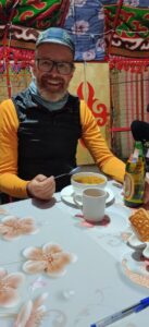
At 06:45, I’m back on my bike. Just as I’m about to start, Katja Kircher rides past. Her saddle screw broke 80 km ago, and she has been riding without it since then. She has tied her heavy saddlebag to her backpack. It’s incredible. There are still 60 km to the town of Naryn. I’m looking forward to food, and Katja is hoping for a repair. Naryn is also known as „Scratch City.“ Many racers drop out here. I take a break for about 2 hours during which I eat pizza, cake, and ice cream and stock up on supplies for the next 2 days.
In the midday heat, now at 33°C, I tackle the climb out of the city. It’s a 600-meter ascent on a well-built road. There’s a storm brewing, the air is thick with dust, almost like being in a sandstorm. I eat a can of fish with bread in front of a magasin (that’s what the stores are called here) before heading towards Kel Suu, CP2. At 19:30, I reach a large meadow by a stream.
There, the ascent to the high plateau at the Chinese border, where CP2 is located, begins. Considering the fact that the journey there will take at least another 7 hours and it will likely be freezing cold at 3400 meters altitude, I decide to take an early rest. Distance covered: 134 km with 1913 meters of elevation gain.
Day 7: Kel Suu CP – Chinese Border
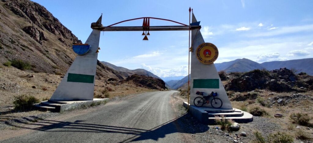
I’m back on the saddle as early as 05:15, climbing 600 meters to the high plateau. There’s a military checkpoint where I have to show my passport. We have a special permit.The weather today is a bit mixed. There are frequent short showers, requiring me to constantly put on and take off my rain gear. By 12:30, I reach CP2, a yurt camp in a spectacular high valley.
Unfortunately, the mountains are shrouded in clouds. Fellow riders who decided to continue the previous night seem to have had a tough time and arrived just before me, sleep-deprived. The rain turned the trails into a sticky mess, but I was spared that ordeal. The food at the camp is excellent. After an hour of carboloading, I tackle the infamous „Old Russian Road“ – a 320-meter ascent over 1.7 km. It’s an hour of pushing the bike at its finest. Then, a dreamlike, quite technical descent on single trails, followed by an 80 km dead straight gravel road.
I reach my goal, the halfway point (941 km), just before midnight. In the darkness, I recognize the border fence with China. I lean my bike against it and swiftly set up my tent. The temperature is already below freezing, not surprising given the altitude of almost 3600 meters.Distance covered: 177 km with 2224 meters of elevation gain.
Day 8: From Cold to Heat
I wake up at dawn. The tent is covered in ice. At 06:45, the wheels turn towards Torugart, a border crossing to China that has been closed for almost 2 years due to Corona. Endless lines of trucks dominate the scene. In an old railway carriage, a Kyrgyz woman offers food and hot drinks to truckers, and now to cyclists as well. Her son greets the riders by their first names, thanks to the MapProgress tracker.
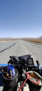
Modern times.This is followed by one of the few paved sections of the tour. The road descends straight down 600 meters toward Naryn. Shortly after noon, it’s back to gravel. A 10 km, 500-meter ascent in 30°C midday heat. Brutal. Another pass with some pushing sections. Behind the last climb, the landscape changes. Dry, eroded canyons, red earth tones.

The eyes can hardly get enough. After a 35 km descent, I reach the town of Baetov at 19:00. A hotel from the Soviet era, past its prime, is now occupied by Silk Road riders. There’s a delicious dinner, a washing machine, and a nearby supermarket. Life can be so beautiful.Distance covered: 173 km with 1546 meters of elevation gain.
Day 9: Battle with the Heat
After a hearty breakfast, I’m back on the trail at 05:50. Today is taking a toll on me, and I’m on the brink of heat exhaustion. First, 80 km on the roughest washboard track, followed by a long climb over a 2900 m high pass in temperatures up to 37°C. Luckily, I find occasional streams to cool off. Behind the pass, there’s a bit of up and down before a nearly 50 km descent on smooth asphalt down to Kazarman.
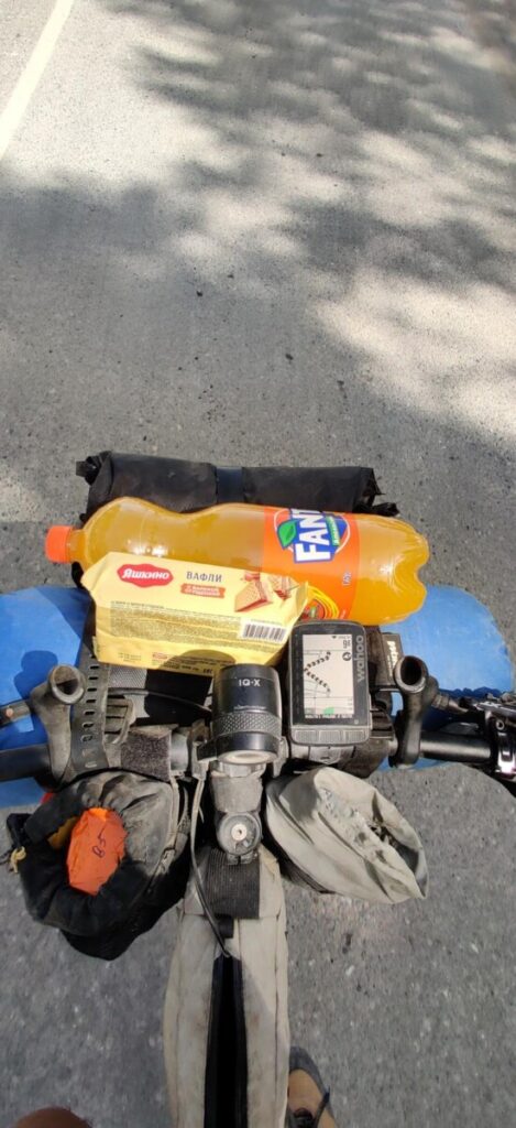
It feels like having a hot hairdryer blowing in your face. At 19:00, I reach the small town, utterly exhausted. I storm the first store I see – kefir, Fanta, ice cream… I find a great hostel, a brand new villa, air-conditioned with a large kitchen. A room with a shared bathroom costs a mere 5 Euros. Peter, a young American, is staying there too. He plans to ride again at 02:00 to escape the heat. It’s Sunday, and all restaurants are closed. So, it’s back to supermarket food. Distance covered: 164 km with 2187 meters of elevation gain.
Day 10: Queen Stage – Climbing Party – CP3
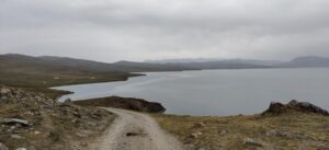
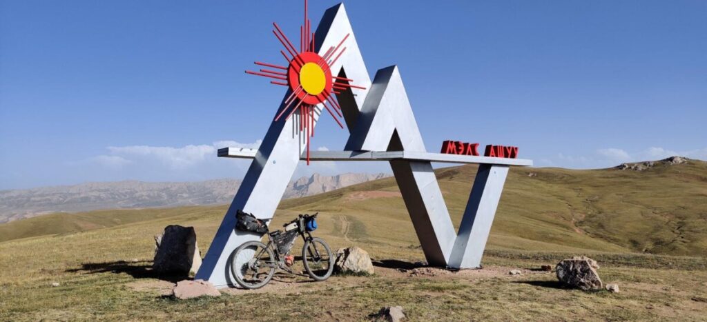
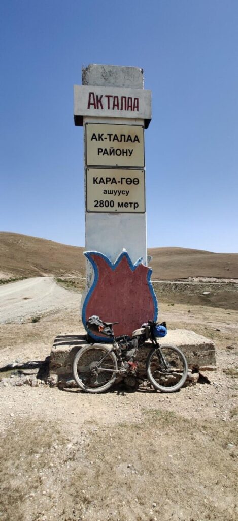
I start the day at 04:50. Three passes await me, and as the crowning achievement, the long ascent to Lake Son-Kul, the large mountain lake at 3000 m altitude where CP3 is located. In the first light of day, I reach the first ascent. Despite the very exhausting day yesterday, I can feel my legs are in climbing mode. At 13:50, I reach the third pass, Kara Koo Ashuu (2800 m), where a winding descent leads down to Jangy Alap. The town is like a green oasis amidst a desert-like landscape. The thermometer now shows 40°C. At the entrance, there are two small stores, unfortunately, no kefir or ice available. Here, I meet Rob again, with whom I spent the second night in the yurt.
I find some shade in a kindergarten playground and pause with Fanta, cookies, and water to prepare for the final ascent. After all, there are still over 60 km with 1600 meters of elevation gain ahead of me. Just before the start of the climb, one last store… Another ice cream, bread, and canned fish. With darkness setting in, I tackle the pass. It’s said to be one of the most beautiful in the country.
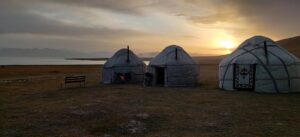
It’s a pity I can’t see it, but I’m determined to reach CP3, which seems realistic. Shortly after midnight, I’m on the plateau and reach the camp just before 01:00 in the morning. Soup, mashed potatoes, fish from the lake, and a bottle of beer crown the day. I share a yurt with 2 other riders. A real bed with bedding. Pure luxury!!Distance covered: 180 km with 4211 meters of elevation gain.
Day 11: Stubborn Struggle and Thunderstorms
After a breakfast with some other riders in the yurt, I hit the road again at 06:30. The legs aren’t the freshest after the monster day yesterday. Single and double tracks run along the Son Kul Lake. The first 2 ½ hours are constant slight ups and downs. Then there’s a short pushing section, followed by a longer descent. The next climb is so steep that it requires about 2 hours of pushing, incredibly steep all the way. Today is an absolute ordeal.
The following descent compensates for all the efforts. First through fantastic meadow tracks, then onto asphalt into the valley. Attempting the Kegeti Pass today seems hopeless, especially since it would be challenging to navigate in the darkness due to landslides. In the valley, there’s oppressive heat again, followed by a thunderstorm with incredible headwind.

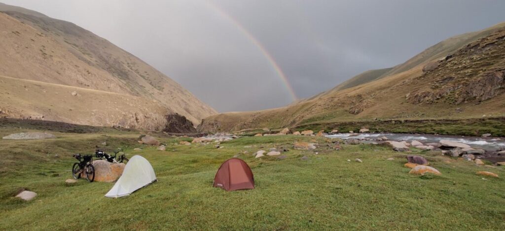
I pass the time with a nap behind a bush. Luckily, it doesn’t rain. Chris, a South African rider, catches up to me, and we cycle together into the valley leading to the Kegeti Pass. According to Chris, there’s a nice camping spot by the river just before the steep part. We reach it at 18:30 and manage to set up our tents just before a heavy thunderstorm hits us. 121 km with 1984 meters of elevation gain.

Day 12: Day of Pushing and Heat
In the darkness at 03:50, I set out for the Kegeti Pass. Unfortunately, I left my headlamp at CP3 the previous day. The dynamo barely provides light while I’m pushing slowly. It takes me 3 ½ hours to cover the 7.5 km, 1000 meters ascent. The upper part of the pass is extensively destroyed by landslides. Climbing steep scree with a 26 kg heavy bike is not exactly fun. Finally, at 07:30, I’m at the top at 3750 m altitude.
A 40 km descent follows, bringing me down to 1250 m. Descents can be exhausting too. Apparently, I push too hard halfway down. I tear my rear tire in a scree field. The 3 cm long cut can’t be repaired, so I have to bid farewell to tubeless (the first and only tire puncture).In Kegeti, I find a store with everything I could wish for: kefir, noodles, sandwiches, ice cream, etc.
Here, at 1200 m altitude, it’s unbearably hot again. I continue on, struggling. I take a nap in the shade at a bus stop. It cools down slightly in the afternoon, and I reach the next pass. Unfortunately, it’s so steep that I have to push again for almost 3 hours. I had planned to tackle the next two climbs today, but schedules rarely work out on such rides. Just before dark, I set up my tent on a beautiful meadow near a stream.Distance covered: 117 km with 3049 meters of elevation gain.
Days 13/14: Merciless Headwinds and the Final Executioner
At 06:05, I set out in the first light and pass two Americans with whom I struggled up the last pass yesterday evening. They camped nearby as well. Just before 09:00, along with one of them, I reach the large rest area (Oasis) on the road from Bishkek to Lake Issyk-Kul. We have Lakhman (noodle dish) with freshly baked flatbread for breakfast and replenish our supplies.
From here, it’s 90 km to the start of the last pass and 155 km to the finish. It could be done in one go. Beyond the rest area, the road turns into the 116 km long Chon Kemin Valley towards Kok Ayrik Pass, the final obstacle before the finish. The heat (36°C) and the ever-stronger headwinds take a heavy toll on me. Maintaining an average speed of more than 8 kilometers per hour becomes nearly impossible. Frustrated, I take shelter behind a bush in the afternoon.
Eventually, I gather myself again. A Canadian couple passes me, rekindling my spirits. They are considering riding through the night. Together, we cycle through the beautiful valley for a while. It gets dark, and the barking of dogs from the farmhouses echoes in the distance. Fortunately, the dogs here are mostly peaceful or confined. Just before the steep climb to Kok Ayrik, around midnight, there’s a knee-deep river. Tired and frustrated, I wade through it. Once again, I miss my headlamp. With one hand on the bike and a cellphone flashlight in the other, I cross the river. I can see the Canadians‘ lights in the distance behind me.

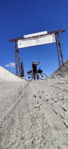
Uphill from the river over a steep meadow, no light and barely a discernible trail; Type 2 fun. At a farmhouse, a bike is propped up. I climb for another 30 minutes on a now visible path and fall into my sleeping bag just before 01:00. I skip setting up the tent. I wake up again shortly after 04:00 and continue the ascent. It takes me a whopping 5 hours for the remaining 12 km. Many landslides, rough scree, dead cows, and goats (apparently due to rockfall). Eventually, I see the pass gate high up in the distance.
Finally, at 10:00, I reach the top. I took a total of 22 hours and 7 minutes for the last 137 km. The subsequent 30 km descent is extremely rough. Now, I can’t afford to get a flat tire.
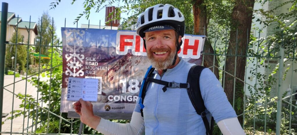
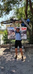
Overjoyed, I finally reach the asphalt road that leads to the last 20 km to the finish. After 13 days and 4 hours, I happily cross the finish line as the 61st participant, 35 hours before the deadline.
In total, 88 riders reach the finish line, 81 of them (out of 144 starters) within the time limit.