Should you be able to swim a brevet? At this year’s Watzmann-Arber-Rundfahrt, this competence would have been in demand. The answer below …
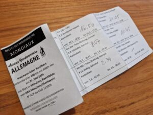
Randonnée Watzmann-Arber-Rundfahrt of the ARA Munich/ Upper Bavaria:
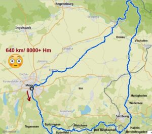
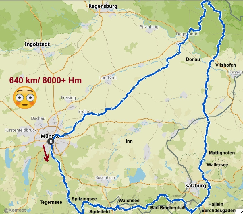
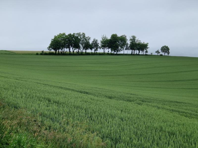
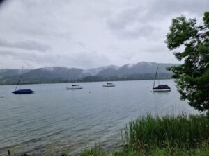
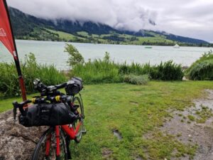
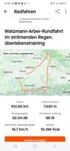
640 kilometres with 8000+ metres of altitude, that promised to be pretty tough. It would probably be good training for the Panceltic Ultra Race. And the brevet would have a lot in common with the Lakes ‘n’ Knödel, the area and the many lakes (Tegernsee, Spitzingsee, Walchsee, Weitsee, Wiestalstausee, Wallersee, Obertrumer See, Mattsee and lots of hilly terrain).
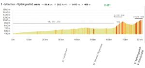
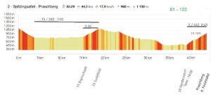
I was a little worried about the target time beforehand. The whole thing was supposed to be completed in 40 hours. That means 1 day, 1 night and 1 day. There wouldn’t be much time for sleep, and probably not much time for a cosy rest in between either. The many metres in altitude would also be a challenge … It was not uncommon for the ascent to be in the double-digit percentage range, sometimes even over 16%.
However, the weather doesn’t promise anything good for the two days of the brevet. Two days of rainy weather. I take this as an opportunity to test my rain gear one last time for my PanCeltic participation, and to do it properly. I still have the option of getting on the next train.
Whether my ‘marching plan’ worked out … Read for yourself …
If you like, here is the short video first:
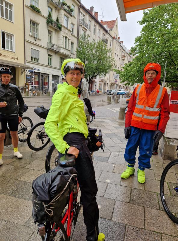
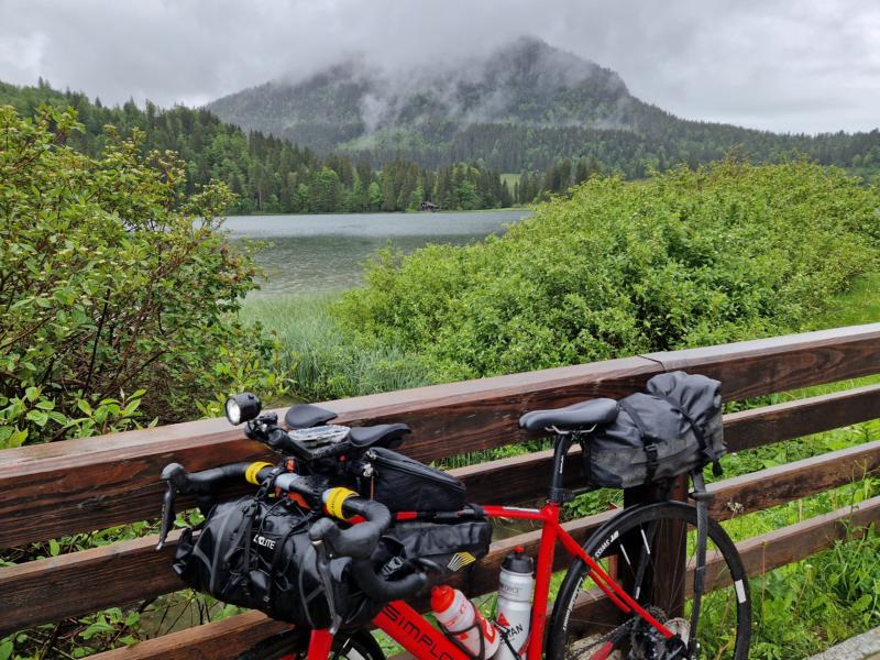
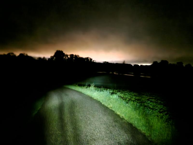
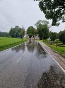
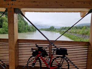
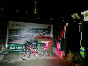
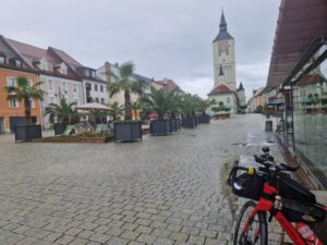
It is pouring with rain at the start.
There were just 1 ½ handful of brave souls at Röcklplatz in Munich for the two 600 kilometre brevets starting at the same time (the Allgäu and Watzmann-Arber tours). There were seven of us, who rode a big loop around Salzburg and then northwards through the Bavarian Forest.
Rain on the way out of Munich. Rain, rain, rain for the 60 kilometres to Tegernsee. The westerly wind doesn’t make it any easier. I’m looking forward to the moment when we turn east and the wind will push us along.
I feel pleasantly dry in my rain gear, even my feet aren’t soaked yet, the Velotoze overshoes are great, but they don’t even survive the first time I put them on, the thin silicone cover is already cracked.
Things get serious for the first time at Tegernsee. Gradients of up to 15 per cent. But the legs are still fresh and the ride into the Valepp is very nice despite the water from above. The ascent is merciful in terms of percentage, well, it’s not so bad after all … (as I had read in the description of the Watzmann-Arber tour).
Spitzingsee brings back memories. This was the course of the Schliersee triathlon back then. I am torn from my dreams of remembrance because at the first checkpoint at Spitzingsattel I discover that my digital brevet card is not working. I can’t upload my coordinates or a photo to prove it. How could that be? The app reports: ‘The start time has been exceeded by more than an hour.’ – Oh dear! I had forgotten to enter the start as the first position in the app during the rain battle.
What to do now? The email to Jörg, the organiser, doesn’t go out straight away. Two riders pass me and I join them. In the meantime, I’ve put on my thin Primaloft jacket under my rain jacket, which has already been soaked in the rain for a few seconds. Not good! Now I have nothing dry for the night …
The descent towards Schliersee is wet and cold, but short, I meet the road at the bottom that I cycled along on the 400 three weeks earlier. At the turn-off towards Bayrischzell, I had seen a snack van last time. I stop there briefly: delicious crumble cake and pretzels and the roof over my head.
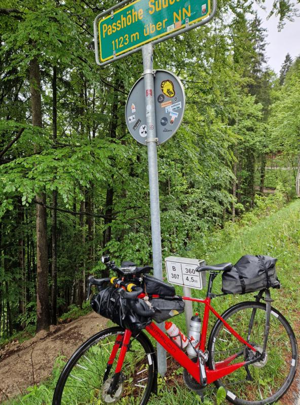
The next ascent to the top of the pass. In the rain, but moderately steep.
I drive carefully down into the Inn valley. I cross the Inn, which carries quite a lot of water. And now it gets nasty, right at the start of the climb up the ‘Niederndorfer Berg’. My speedometer shows double-digit percentages. The gradient is always between 15 and 18 per cent (well, there you go!) and I push my bike for quite a while. In the rain.
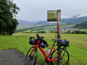
In Kössen, cake and latte macchiato (as always with 2 sugars) and hooray! It has stopped raining and the sun comes through briefly. I quickly hang up my wet clothes around my table. It must look like a homeless person’s place …
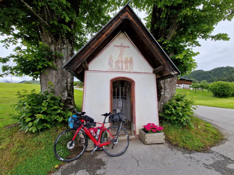
The calories from the chocolate cake are immediately utilised. The ascent to the next checkpoint, the Kornbichl chapel, is ‘poisonous’, with my speedometer reading over 15%.
As we continue through the beautiful Chiemgau region, past the tourist town of Reit im Winkl, one of us participants comes towards me. Is he the next one to give up?
The terrain is fine to ride, a bit up and down. I take a short break to look after my bike, my chain has a beautiful silvery sheen, not good, I get out my lubricating oil and grease it up. Then onwards.
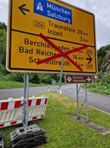
A little later, the shock. The road I was supposed to take is closed. Diversions? How much of a diversion would that be? I’m a bit lost at the roadblock. A car stops, but they don’t know their way round. There’s a car coming from the direction of the roadblock with the licence plate TS, he should be familiar with the area. I give him a hand signal to stop. He does so. I could drive on without hesitation. Thank goodness!

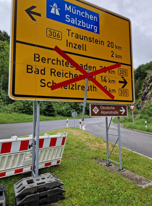
There should be no more supply options after Hallein at the latest, so I decide to ‘invade’ a supermarket in Bad Reichenhall and stock up on supplies. High time, the shop assistants are already slowly clearing out. Kefir, salted nuts and, in preparation for Scotland, a packet of delicious shortbread, sweet shortbread biscuits with lots of sugar and butter. And a Snickers bar to comfort the soul at night.
I had time to do the maths as I drove on. Experience shows that you can only do this at a snail’s pace. I’m only at kilometre 200, the day is almost over … and I’m only a third of the way through and still have more than half the altitude ahead of me. If I continue at this pace, the calculated 22:00 the next day will probably be nothing. Even if I do without sleep.

After Maria Gerne, a small place of pilgrimage, it’s super steep again. And I have to descend the same route again. On the descent, I meet a participant, the one who had met me earlier. He tells me that he had overlooked the last checkpoint and had to go back a few kilometres and metres in altitude, poor guy!

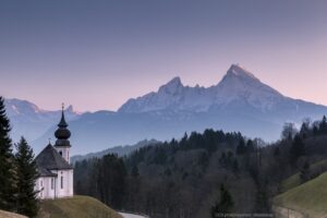
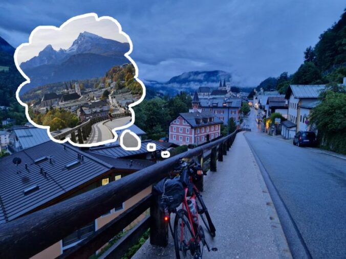
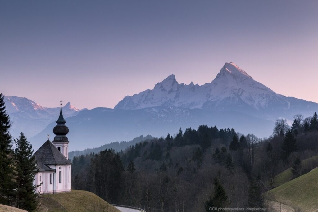
In Berchtesgaden you would have a spectacular view of the Watzmann. Had … I’ll take a picture without …
Now there is another climb with a hiking section. 18%!
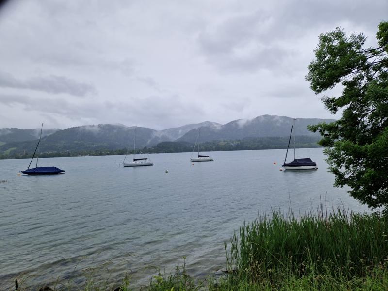
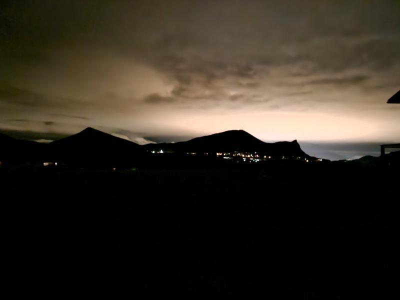
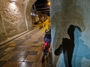
Past Hallein and now it’s getting lonely and very dark. And at the Neuhäusel checkpoint it is really dark. In the distance, however, a bright diffuse glow on the horizon. This must be the ‘light pollution’ of Salzburg. It starts to drizzle again. Still possible without rain trousers.
But the rain gets heavier after midnight. I decide to look for a place to sleep. At home I had made a note of a playground in Seekirchen. I do two laps of the square, there doesn’t seem to be a covered area. But there it is! A small wooden frame with a roof, a rope swing hanging from it, a hollow underneath filled with bark mulch, nice and dry. Just enough room for me and my bike. I put on dry clothes, unroll my bivy bag and sleeping bag and make myself comfortable. And it really is, I toss and turn on the soft surface and quickly find a comfortable sleeping position.
As soon as I am ‘submerged’ in my sleeping bag, I hear a few beeping voices and laughter. It must be three people walking from device to device and apparently having a lot of fun. Then they come closer. It must be a mother with her two children, speaking in a language I don’t recognise. What are they doing here at this time of night? It’s well past midnight and it’s raining lightly.
I’m annoyed because of course I can’t sleep with the noise. Then they trampoline next to me for a while. And only now do they seem to notice me. They are now very close and seem to be standing there speechless. Quiet discussion. They must be talking about me. I move, but luckily they move away.
But sleep doesn’t want to come, I doze off, listening to the ever-increasing rain drumming on the roof. I pack my things at half past three.
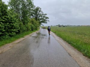
The profile of the route is fine, if only it weren’t for the pouring rain. At a short stop, I see that another two participants have apparently ‘thrown in the towel’ in Vilshofen. Am I perhaps the only crazy person still doing this?
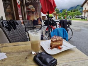
I daydream, a dry biscuit and a latte macchiato and breakfast appear before my inner eye. How little could make me happy now?
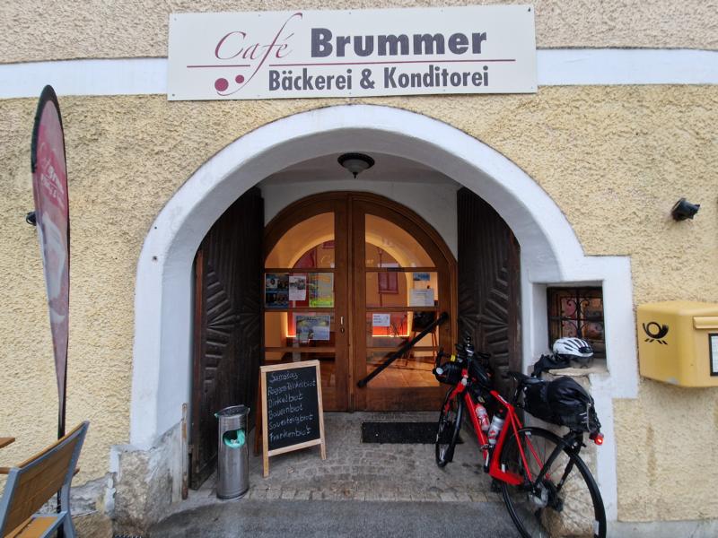
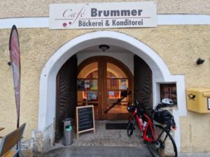
Someone must have taken pity on me. In the next village, Kößlarn, I see a sign ‘Café Brummer – Bäckerei & Konditorei’ out of the corner of my eye a little off the track – I approach the shop hopefully. Opening hours … Saturday from 6:00 a.m.; I look at my watch, which I laboriously uncover between my wet jacket sleeve and neoprene rain gloves: 5 to six. What luck! I am blissful, there are the most delicious bakeries, pretzels with butter, latte macchiato (with 2x sugar!), I can ‘freshen up’ in the toilet area.
I am reluctant to leave this very cosy dining room and leave a large wet stain on the fabric-covered seat. Sorry! But it dries again while I have to go out into the wet cold. Horror!
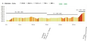
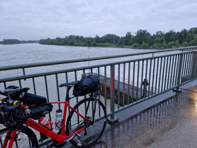
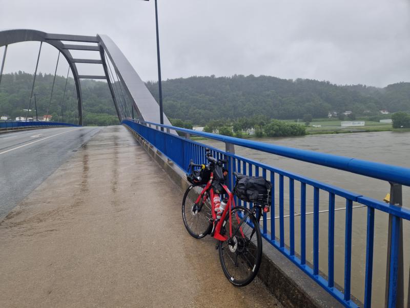
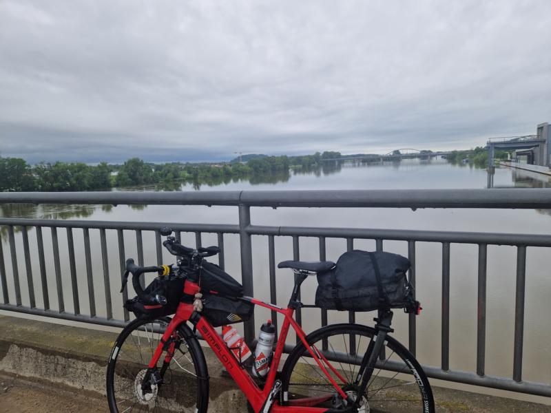
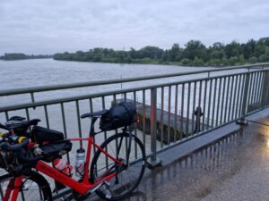
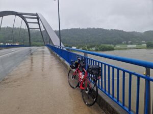
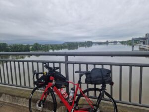
Behind the veil of rain, I imagine what the landscape would be like in fine weather. I think this is already the Bavarian Forest. At the Vilshofen checkpoint I have to cross the Danube, some people are standing at the railings and marvelling at the high water level. Almost frightening.
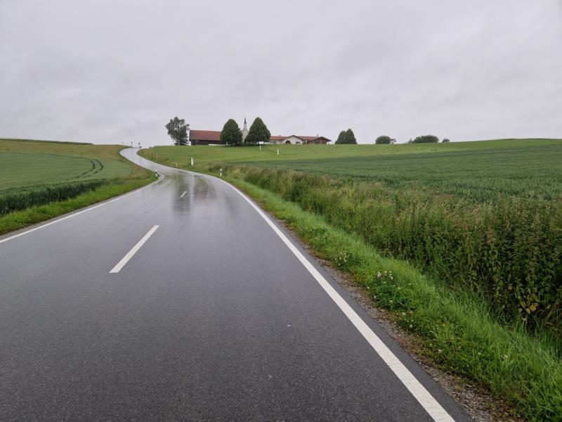
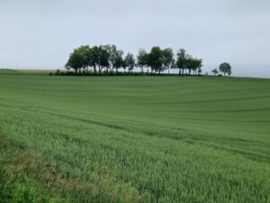
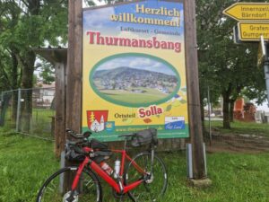
I am now fully immersed in the Bavarian Forest. Very beautiful. Some ups and downs before the climb to Solla. On the first kilometre I am forced out of the saddle again. Pushing is also quite tedious on this ascent. But every climb is followed by a descent. The rain has eased and the sun briefly peeps out.
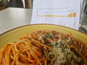
It’s just after midday and I suddenly start yawning on a tour. I decide to give in to the urge to sleep when a bus shelter is just perfect for a power nap. I set my alarm for 10 minutes, use my helmet as a pillow and even manage to fall asleep for a short while. I feel fresh for the following climb. Then a super-fast descent through the forest and I roll into Frauenau. An Italian restaurant with South Tyrolean chefs. I treat myself to a plate of spaghetti alla Bolognese. I must have looked very hungry, because no normal person could possibly manage the portion they serve me …

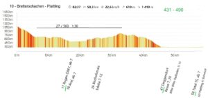
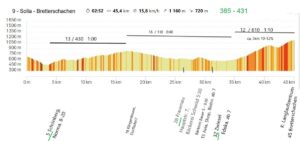
Strengthened, I can now tackle the Bretterschachten, a climb of almost 1200 metres in altitude. This is the longest continuous climb after 400 kilometres in my legs. But apart from a short section, the ascent is human.
Shortly before the highest point, it has ‘finally’ started to rain again, I get off my bike briefly to have a drink. The narrow road here in the shade of the forest is overgrown with moss or lichen. As I try to get back on, my left foot slips, I slowly tip to the right and I can’t manage to click off with my right foot, which is already locked into the pedals. I approach the ground in slow motion. Then I’m half under my bike. My foot is still stuck and I can’t manage to free it from the pedal. The loaded bike presses me against the ground. How am I supposed to get off? From the outside, I look like a beetle that has fallen on its back. Eventually I’ll be free again. Later I will see that my upper thigh is covered in a large bruise.
The control point 9, Bretterschachten, is reached and with it the northernmost point of my journey. Normally you should be able to see the Großer Arber from here. Unfortunately not today. It’s still drizzling.
In addition to the heavy rain that has started again, I now encounter another problem. My Garmin suddenly only shows a standardised map instead of the one in the direction of travel. That’s irritating. If I’m travelling north, there’s no problem. The same goes for travelling south, because the directional arrow on the map simply comes towards me. Things get complicated when I turn west, which is to the left on the map, but I have to turn right. The last 150 kilometres require a lot of thinking on my part. I look strainedly at the screen on the descent and don’t realise that I’m driving in the opposite lane. Luckily no cars are coming. Gabi, watch out!

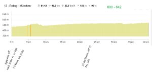
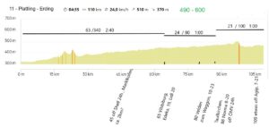
In Plattling, at the last checkpoint, it is already half past seven. From this point onwards, perhaps nomen est omen, there should be no more major climbs. The last 110 kilometres should be easy to cycle. I would probably be in Erding after a maximum of 4.5 – 5 hours. Uli wanted to pick me up there at 1 a.m., as there are no more public transport services at this time of day and, as an experienced randonneur, he is used to travelling at night, so it would be no problem for him to stay up all night … This is already the second night for me. I feel like I’ve almost reached the finish line …
BUT firstly, things turn out differently and secondly, things turn out differently than you think … My assumptions should be a typical case of ‘Think again!’.
Firstly, the wind, which had been blowing strongly for two days, had not changed direction and so the tailwind, which was initially desirable, now turned into a nasty headwind or a nasty crosswind for me. My legs, which were no longer quite fresh, didn’t like this at all.
And the route is not ‘flat’ either. Every few kilometres there are hundreds of metres of steep downhill and then very steep uphill again.
The next problem turns out to be my Garmin. The standardised map means even more thinking in the dark. My brain is probably no longer quite up to it. I get lost X times, once I drive around a roundabout three times before I find the right exit. I mentally berate Uli, who had told me that he always drives with a standardised map, because it’s sooo easy. It really irritates me when the direction arrow doesn’t move in the direction of travel.
It’s now a rain break again, I can take off my overtrousers, what a relief.
There are no gradients worth mentioning at the moment, so I speed through the night.
Ohhhhhhhhh! A gush of water spills over my thighs. My front wheel cuts through a dark, viscous mass. In a matter of seconds, I start pedalling like crazy. The water is up to my knees. With my last ounce of strength, I pedal to the ‘other side’. What was that? A dip in the country lane had probably been flooded by the constant rain. I cycle on with trembling knees. My thoughts start to spiral: What would have happened if I had stopped in the middle of the ‘lake’? Or worse still, if I had fallen over? Or even worse, if I hadn’t been able to get off the clipless pedals like I did on the boardwalk … Drowning on a cycle path? I ask myself whether swimming should be a compulsory skill for a brevet … And despite everything, I have to giggle.
But now I have to put my rain trousers back on because, as I said, I’m soaking wet up to my knees.
Presumably St Peter notices this too and opens the floodgates a little later.
The game is repeated a few more times for me and my ‘amphibious vehicle’, but the puddles are no longer as deep and long and I’ve been warned in advance.
At some point, it’s well past midnight and the route stretches like chewing gum. I always say that you shouldn’t visualise the whole route, but only as far as the next corner. As I can’t see any in the dark, I have to come up with a different motivation strategy. I always cycle in a 2 ½ kilometre rhythm. Then another 2 ½ are already five kilometres. Another 2 ½ and again, then I’ve done another 10 kilometres. And that’s 11 kilometres in a row …
In any case, I’m almost there shortly after two o’clock. Almost … The cycle path leads over a small bridge. I can see that the water barely makes it under the bridge. I can’t see much else in the light of my headlamp, but ominous noises reach my ears. A gurgling and gushing. A few metres downhill from the bridge, my headlamp sweeps across a reflective surface of water. I brake abruptly. The light goes out. My helmet light, which I switch on in such cases, doesn’t work. Water has probably got in and caused a short circuit. I push up again and when I go back down I can’t see as before. All I know is that the watercourse here has burst its banks. I have no idea how long the cycle path is under water. I get into the water, my shoes are already wet from before, it’s up to my knees at the edge. I’m standing in pitch darkness. My mobile phone light doesn’t shine any further. Back again!
I call Uli, who is waiting two kilometres further on. „Uli, I don’t dare go any further. What can I do?“ Uli reacts pragmatically. ‘I’ll come and light up!’ Relief on my part. It’s so scary in the dark with those ominous water noises.
As the flooded area turned out to be quite large, Uli drives towards me, hoping that the path is underneath. It sinks into the black wet right up to the top of the tyres. No, I wouldn’t dare go through that. So I treat myself to a ‘ferry crossing’ of an estimated 100 metres.
My Garmin sat nav also gave up the ghost shortly before, either water got in or I accidentally touched the screen during my water manoeuvres and switched it off. High time we all went to bed …
My Garmin sat nav also gave up the ghost shortly before, either water got in or I accidentally touched the screen during my water manoeuvres and switched it off. High time we all went to bed …
Peter S.’s comment now makes me smile in retrospect: “You were really lucky again, because it only rained once”
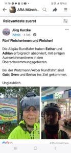
Jörg writes the day after:
„I’m still impressed by your performance, although it was a bit reckless with THE weather forecast. Not necessarily worth imitating. In any case, I was trembling along with you and am delighted that everyone – including those who dropped out – made it home safely.“
(Note: There were 3 of us at the finish of the Watzmann-Arber-Rundfahrt and 2 participants in the Allgäu-Rundfahrt, which was running in parallel. Among us 2 women!)
I, Lumacagabi, would like to emphasise once again that I would certainly not have started if the flood disaster had become apparent at the start on Friday morning. This weekend will go down in history in the Bavarian region. Where people are fighting for their belongings, I don’t think it’s right to go on a kind of disaster tour on the bike. On the way, however, I never had the feeling of being in danger, apart from the few encounters with water.
And: The route is marvellous!
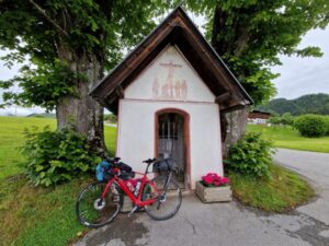
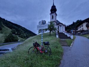
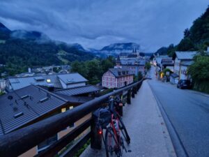
impressions:


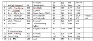
planning: