
A loop through some of Italy’s most unspoilt landscapes: the Wolf’s Lair takes you across Abruzzo, past remote mountain villages and wild valleys, and through several national parks.
We had around 390 kilometres and more than 8,000 metres of climbing ahead of us, mostly on gravel roads and quiet backroads. And somewhere out there, there were bears 🐻 and wolves 🐺, too.


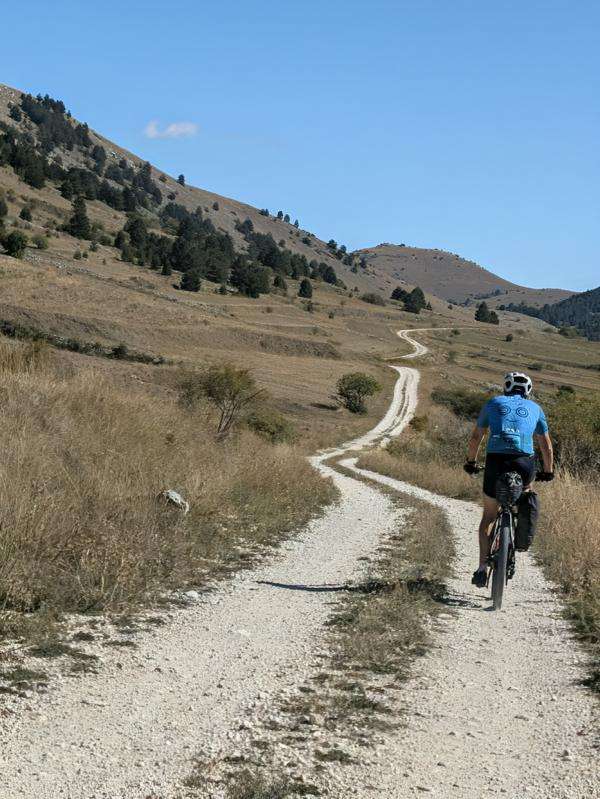
We had originally planned to ride the loop in four days. Judging by the numbers, it seemed doable. But on a route like this, distance and elevation gain don’t tell the whole story. In the end, choosing to take five days was absolutely the right call.
We got the idea for Wolf’s Lair from Montanus.
Here you can find out how much hike-a-bike there really was and what the trails felt like beneath our tyres.
The Wolf’s Lair in 5 days
- Day 1 – 64 km / 1,770 m : Sassa Scalo – Calascio
- Day 2 – 92km/ 1100m: Calascio – Caramanic Terme
- Day 3 – 95km/ 2200m: Caramanico Terme – Villetta Barrea
- Day 4 – 80km/ 1600m: Villetta Barrea – Gagliano Aterno
- Day 5 – 71km/ 1600m: Gagliano Aterno – Sassa Scalo
- Route planning
More information here too: bikepacking.com
Day 1: Climbing to Calascio on gravel – from Amiternum to the Rocca
64 km / 1,771 m elevation gain / approx. 6 hours moving time
First, our video from Day 1:
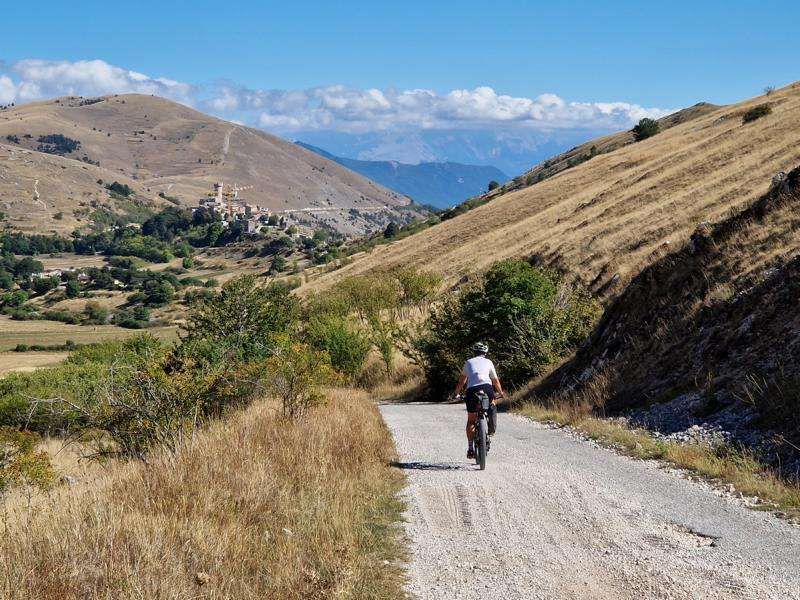
Our ride begins at the archaeological site of Amiternum, near San Vittorino, close to L’Aquila. The ancient city was once an important Sabine centre and later became a Roman city. Today, its theatre and amphitheatre are among the reminders of its past. National Museum of Abruzzo: Amiternum Archaeological Park
The night before, we stayed at B&B Grandangolo in Sassa Scalo. They let us leave the car there, which is handy because our final stage on Day 5 brings us back this way. The roughly five kilometres to the official starting point make for a good warm-up before the climbing begins in earnest.
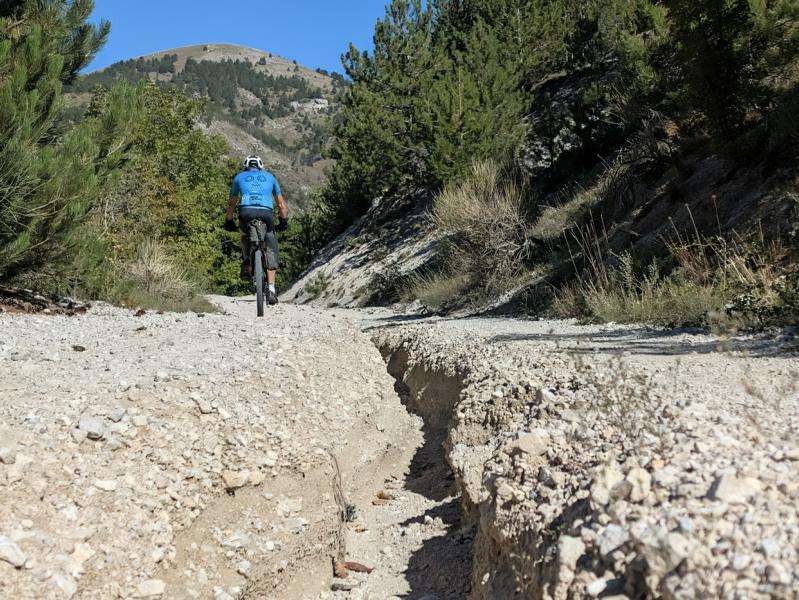
We leave San Vittorino on gravel roads and are soon heading uphill. A spectacular series of hairpin bends takes us up to Piano del Monte at around 1,170 metres. After just the first few kilometres, I’m already glad I chose a mountain bike. The gravel makes itself felt as the landscape opens up and grows quieter with every metre of elevation. At this time of day, we don’t see another soul up here.
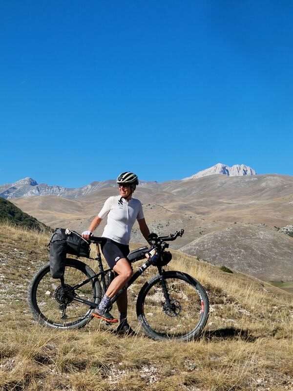
We pass through Collebrincioni and descend towards Camarda. Then another plateau awaits: wide and lonely, with long stretches where we don’t meet anyone for kilometres. It only gets busier as we approach Santo Stefano di Sessanio.
The medieval village sits at around 1,250 metres in the Gran Sasso and Monti della Laga National Park. Its narrow lanes, stone houses and passageways seem to belong to another age. As we ride through, it’s easy to imagine what everyday life here might have been like centuries ago. Today, we share the lanes with visitors strolling through the village and stopping every so often for a photo. Abruzzo Tourism: Santo Stefano di Sessanio
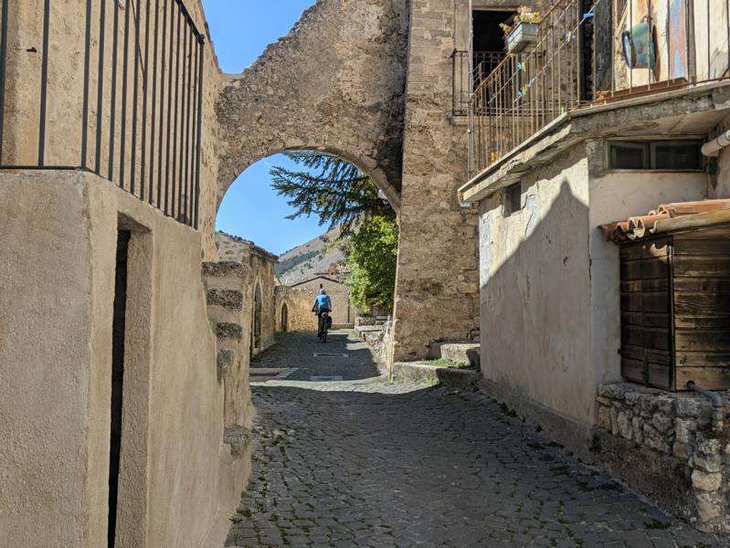
We take a short break for coffee and ice cream. But we don’t linger: before long, we’re back on our bikes and climbing again. The road leads out onto a stark, open plateau. At last, Rocca Calascio appears in the distance – first as a tiny outline on the horizon, then growing clearer above the mountain landscape.
The fortress stands at around 1,460 metres and is one of Italy’s highest fortifications. It is also famous as a film location: scenes for The Name of the Rose, among other films, were shot here. Nearby stands the small, octagonal church of Santa Maria della Pietà, built between the late 16th and 17th centuries. Abruzzo Tourism: Rocca Calascio

A steep, winding road takes us to Calascio. The village clings to the hillside just below the fortress, like an eagle’s nest. Our accommodation, Casa Arcem, is right in the centre and can only be reached via stone steps. We can leave our bikes outside the house. The room is cosy and has everything we need for a short stay. After such a long day, we hardly notice that it has no windows.
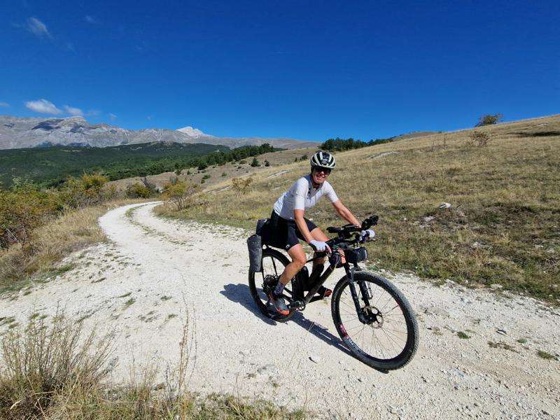
We don’t get to meet Federica, our host, in person, but she sends us all the information we need via WhatsApp. She also recommends Trattoria Da Clara. We end our first day on the bike with traditional dishes in a welcoming atmosphere. A few snacks and a cappuccino set us up for the next morning.


Day 2: From the high plateau into the beech forests – from Calascio to Caramanico Terme
91.68 km / 2,090 m elevation gain / 7:30 hours moving time / 9:30 hours total time
We leave Calascio too early to have breakfast at Bar Nido del Falco. Luckily, there’s coffee and a few snacks at Casa Arcem. As soon as we get on our bikes, we take a little detour I wouldn’t repeat: we leave the road and struggle downhill on a hiking trail, only to sweat our way back up to the road. Next time, I’d simply stay on the tarmac for the first four kilometres.
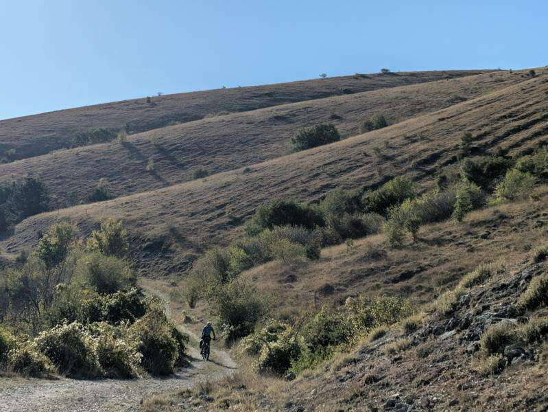
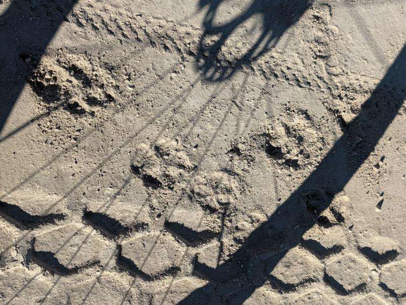
We head north at first, taking a wide loop around Castel del Monte. The village comes into view just as we turn onto gravel. We don’t stop for long, though; the mountains are calling. The gravel is new and well packed. I spot some tracks in the pale surface. There are no houses anywhere nearby, and no footprints either. Could they be wolf tracks? From then on, I keep glancing around warily as we ride.
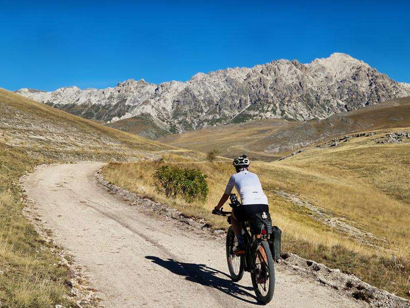
We venture farther and farther into the wilderness. The well-maintained stretch is long behind us. The trail climbs, sometimes steeply, sometimes more gently. It’s all manageable on our mountain bikes. Even so, I’m glad I’m not riding a gravel bike – a feeling I’ll have many more times on this trip.
Near a mountain pasture, Hermann suddenly stops to film. But why is he filming a large, white, dead dog? Poor thing! When I reach it, it comes to life and lifts its head. So it wasn’t dead after all – and thankfully, it’s perfectly calm.
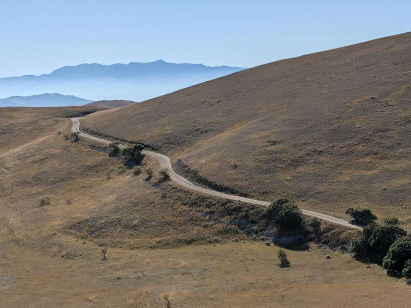
And then, who would have thought it: another stretch of well-maintained gravel road. A few motorbikes race uphill along the hairpin bends. We soon reach the highest point. From here, we have a magnificent view over the foothills of Campo Imperatore and the two peaks of the Gran Sasso: Corno Grande and Corno Piccolo.
We turn right and miss the sign marking a filming location for They Call Me Trinity. Until now, we’ve hardly seen another soul. Up here on the plateau, it’s suddenly bustling with people.
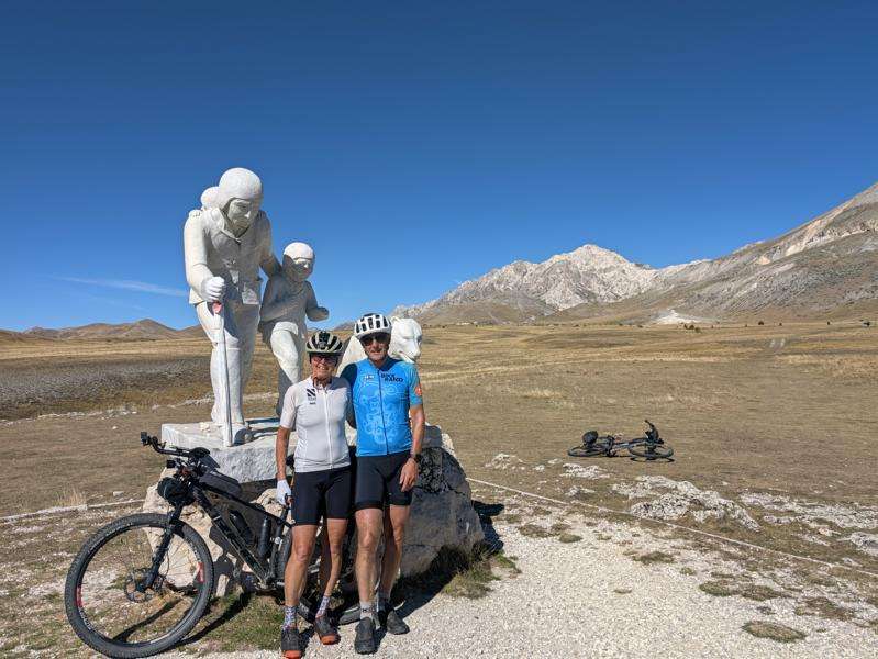
We make a short detour to see a marble monument. It commemorates the shepherd Pupo Nunzio di Roio, his two young sons and a flock of around 5,000 sheep. In October 1919, they were caught in a violent snowstorm and lost their lives. The monument also honours all the shepherds who have died in these mountains. A sad place. The story behind the monument
We have to press on. A large flock of sheep is approaching, and we can’t see a shepherd anywhere. I’d rather not get too close to the big white Maremmano-Abruzzese sheepdogs guarding them. They take their job of protecting the flock very seriously.
We leave the popular Ristoro Mucciante behind. But I really want a coffee, so I turn into the next ristoro, across the road. It looks deserted and is probably already closed for the season. But the smoke rising from the grill tells a different story: it’s open! We manage to get a coffee, too. The shepherd family who own the flock outside make cheese here. They don’t have enough change, so for one euro each we get a generous piece of sheep’s cheese. I think we got the better end of that deal.
Our run of good luck with tarmac doesn’t last long. Soon we’re back off-road. We pass the crumbling remains of Rifugio Ricotta and struggle uphill over some seriously rough ground. Thank goodness for mountain bikes!
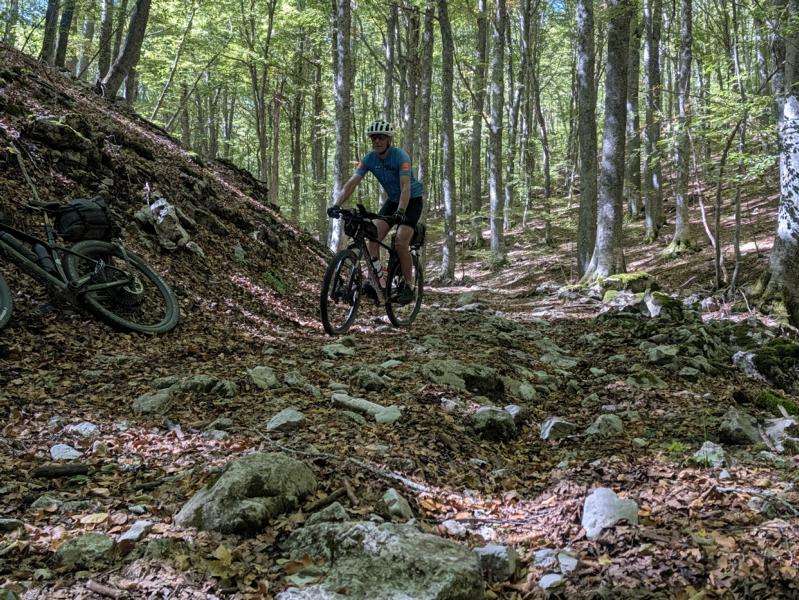
Then the trail takes us through dense beech forests. Damp, decaying leaves lie among the stones, so we have to tread carefully. Some of the steep climbs are only manageable on foot. When we emerge from the forest, we’re almost speechless: a vast open landscape stretches out before us. The trail looks inviting from a distance, but it’s full of holes and tufts of grass. This is no place to pick up speed.
At last, we reach Rifugio Sasso Vivo, only to find it closed. When we were planning to complete the loop in four days, we’d considered staying here overnight. It has already taken us four and a half hours to get here from Calascio. It’s hard to imagine having to add this section to the previous day’s ride – perhaps in the dark, through those gloomy, slippery beech forests. No, thank you. Taking five days was absolutely the right decision.
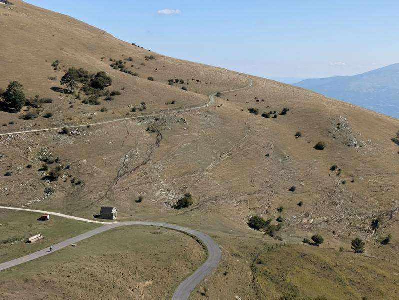
For the next few kilometres, we enjoy a smooth descent on tarmac. Then it’s back off-road: a bit of up and down, a short stretch on the road, then more gravel and farm tracks. The descent to Pescosansonesco gets pretty steep in places.
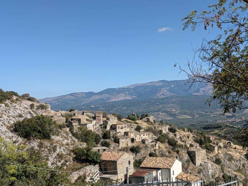
The old village of Pescosansonesco Vecchio sits dramatically on a rocky outcrop. After damage from landslides and earthquakes, it was largely abandoned; the newer settlement was built a few kilometres away. We continue downhill and cross the Val Pescara, the valley of the River Pescara.
In Tocco da Casauria, we treat ourselves to a delicious gelato at Un Tocco di Gelato – what a fitting name! The owner makes us a little anxious, though. He says Caramanico Terme is still a long way off and the road is very twisty. And we’re planning to get there today? I start worrying that we won’t make it before dark. In the end, it takes us just an hour and a half. I guess people sometimes underestimate us “oldies”.
From here on, it’s tarmac all the way. First we descend, then climb gently up to Musellaro and continue to Salle. I remember the village from planning the route: it lies near the Gola dell’Orta. Salle consists of the newer village and Salle Vecchia, the old medieval settlement with its castle. We cross the River Orta on a high bridge. Far below, the river has carved a spectacular gorge into the rock: the Gole dell’Orta.
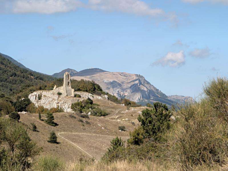
There’s another sight along the way: the Romanesque Abbey of San Tommaso Becket, about five kilometres before Caramanico. According to legend, a church was built here as early as 45 AD, following an apparition of the Archangels Michael and Gabriel. The present-day abbey, however, was not begun until 1202. Some scholars believe it stands on the remains of an ancient temple dedicated to Hercules. Information from the Municipality of Caramanico Terme
We’re now just ten kilometres from our accommodation. Caramanico Terme lies at the entrance to the Orfento Valley, in Majella National Park. After the open plateaus of the Gran Sasso, the change of scenery is wonderful: this is where the gorges, riverside trails and beech forests begin.
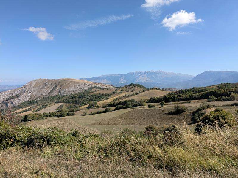
The village climbs up the hillside. To avoid the tunnel, we follow the little streets through town, getting a bit turned around in the process. We soon find Hotel Orsini. After a lovely hot shower – the evenings are getting chilly now – and a little chat with our host, we head out for pizza at a nearby restaurant. The hotel owner’s recommendation is spot on.
We’ve well and truly earned a good night’s sleep. After more than 90 kilometres today, I’m very glad we don’t have to ride any farther.
To start with: the next morning, the breakfast, with its many homemade treats, makes us set off later than planned.


Day 3: Caramanico Terme – Villetta Barrea
95.47 km · 2,167 m elevation gain · 7:30 moving time · 9:30 total time
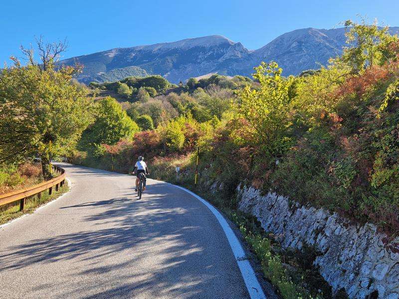
We start on a pleasant asphalt climb, passing through Sant’Eufemia a Maiella. We had originally planned to spend the night here, but there was no accommodation available. That adds around six extra kilometres to today’s ride.
The road continues uphill through a series of bends. High above us sits Roccacaramanico, a small medieval village at about 1,050 metres. Earthquakes and migration from the mountain villages left it almost completely deserted during the 20th century.
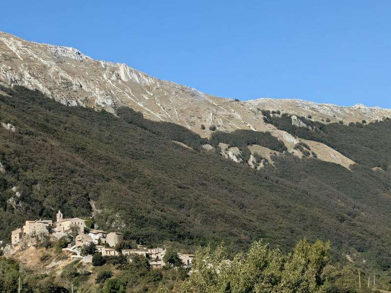
Some houses have since been restored, but the village still feels quiet and nearly abandoned. We leave it on the mountainside and continue towards Passo San Leonardo, at 1,282 metres. At the top, we cross from the Valle dell’Orta towards Pacentro and Sulmona.
A long descent follows, including a gravel shortcut. We pass through Campo di Giove without stopping. The village is a popular destination for skiers in winter and hikers in summer. At 1,064 metres, it is considered the highest village in Majella National Park. Its medieval centre, with its narrow lanes, stands at the edge of a broad plateau.
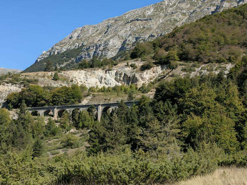
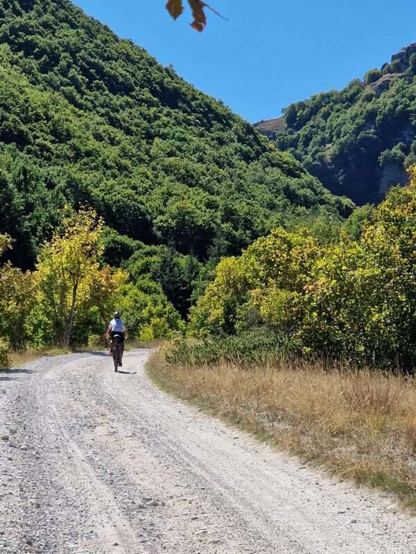
Just beyond Campo di Giove, we leave the road and head off-road. The track is easy at first, but soon turns into a steep climb. The deep gravel slows us down, and we have to push our bikes in several places. I feel for a group of Belgian gravel riders we keep meeting along the way. Then again, even on my mountain bike, I’m not always doing much better.
Partway up the climb, we pass beneath an old stone railway bridge and return to the road. The stone arch overhead makes for a striking sight. On the SP 12 Frentana, we reach Valico della Forchetta. Down in the valley, the road meets a bar near the remote Palena railway station. It would be a good place to stop for a drink, but we press on.
The flat road takes us to Rivisondoli, though we leave the village above us. This mountain town sits at around 1,320 metres and is best known as a winter sports destination. Together with Roccaraso, it forms a large ski area. Rivisondoli-Pescocostanzo railway station is also notable: at 1,268 metres, it is one of Italy’s highest stations and lies on the historic line known as the Transiberiana d’Italia.
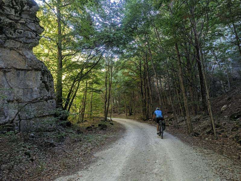
Below Rivisondoli, we come across a green-surfaced cycle path. Our route takes a slightly illogical detour, so you can simply stay on the cycle path if you prefer. We ride off-road over a hill and, after descending, head southwest towards Montagna Spaccata. The name means “split mountain” and refers to the dramatic cleft in the rock. The gorge is also a hiking destination. The picnic area looks a little neglected, but it still works for a short break. The bubbling drinking-water fountain is especially welcome.
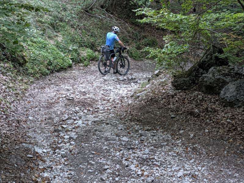
After a few short, steeper climbs, the landscape opens onto the broad uplands of the Altipiani Maggiori d’Abruzzo. At the top, we take in the views and pause to prepare ourselves for the descent ahead. Komoot has marked it as difficult—and for good reason. First, we descend steeply over a rocky track, then continue along an equally stony footpath. For about two kilometres, we spend more time pushing than riding. Good bike-handling skills are needed here.
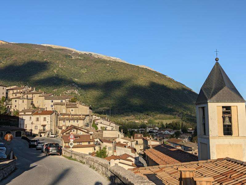
At around 1,200 metres, another climb begins almost immediately. A gravel track takes us back up to the asphalt road. It’s less than five kilometres and 300 metres of climbing—we can manage that. From Valico di Monte Godi, the highest point of this section, we then descend for about 15 kilometres to Villetta Barrea.
The village lies on the shore of Lago di Barrea, in the heart of Abruzzo, Lazio and Molise National Park. It nestles against Monte Mattone and grew around a 14th-century castle. The lake is a reservoir built in the 1950s. With its water, mountains and deer along the Sangro, Villetta Barrea feels like a little oasis. After the lonely uplands, we find ourselves back in a lively village.
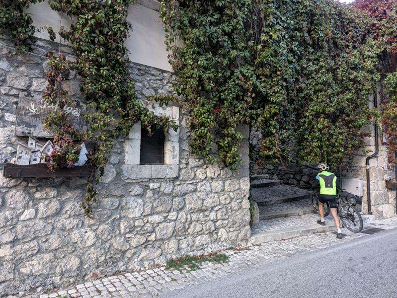
We spend the night at B&B Il Rifugio nel Parco, run by Stella and Berto in the centre of the village. At first, the entrance is almost hidden behind thick Virginia creeper. From the outside, the place looks tiny, so it’s hard to imagine that it has six cosy rooms and a breakfast room. We’re also allowed to squeeze our bikes into the communal area.
For dinner, we’re warmly recommended the neighbouring Il Giardino sul Sangro pizzeria. We’re happy to recommend it too—as well as the B&B. And the breakfast, all homemade by Stella, is fantastic.


Day 4: Villetta Barrea – Gagliano Aterno
80 km · 1,600 m elevation gain · Moving time: 7:15 · Total time: 9:15
A challenging stage through remote valleys, along wild mountain trails and right through the heart of Abruzzo.
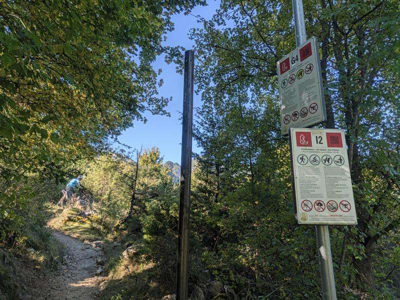
Leaving Villetta Barrea, we climb to Civitella Alfedena. The ascent is very steep at first, then continues on gravel. Eventually, the route joins a hiking trail. Two signs leave us puzzled: route G4 is closed to cyclists, while route I2 is open. But which trail is which? Take a look at the photo and decide for yourself. We interpret the signs as meaning that we should turn left to stay on the permitted I2 route.
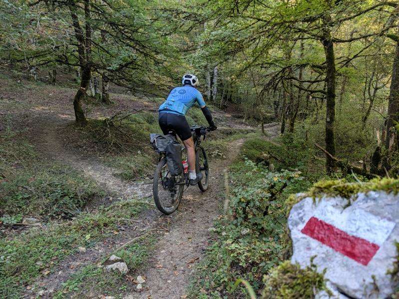
The trail winds through a beech forest. We have to push our bikes in a few places; more technically skilled riders might manage the whole stretch in the saddle. The hiking trail is about two kilometres long, after which we reach asphalt again.
To avoid this scenic but demanding section, turn right in Villetta Barrea after leaving the B&B. After about two kilometres on the main road, you’ll rejoin the route in the Sangro Valley at the same point we reach after roughly ten kilometres. Civitella Alfedena is well worth a visit, though.
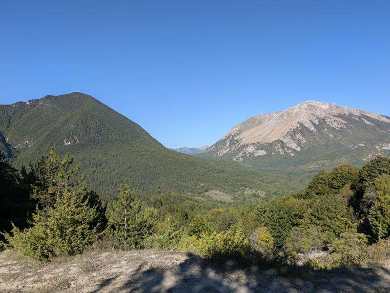
We continue on asphalt, passing Opi on the way to Pescasseroli. This is the last place to stop for food or a drink. After that, there’s nowhere to resupply for around 35 kilometres, until Pescina—and many rocky trails—later.
We climb gradually through the Sangro Valley to Passo del Diavolo, then enjoy a long descent. The view opens up over the Piana del Fucino, the Fucino Plain, far below. It covers the basin of the former Lake Fucino, which was drained.
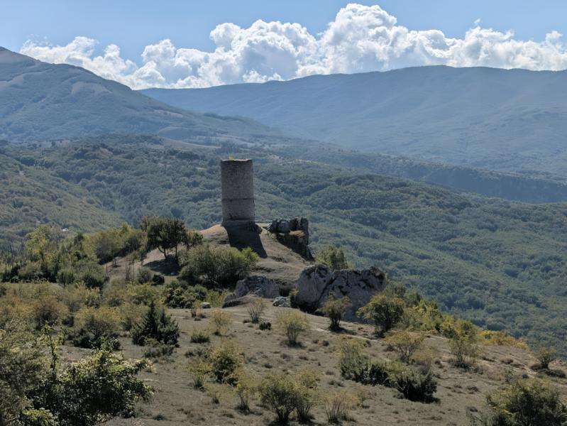
A few kilometres beyond the village of Gioia, around kilometre 40, we turn right. The gravel road gets rougher, and in the distance we catch our first glimpse of Torre di Sperone. Information boards explain that scenes from Riccardo Milani’s 2024 Italian film “Un mondo a parte” were shot here.
After lunch at this spectacular, completely deserted spot, we set off again. The tracks become increasingly rugged. Pescina is only a little over 15 kilometres away, but progress feels painfully slow. The surface is strewn with loose rocks, and steep climbs sometimes force us off our bikes. It takes full concentration.
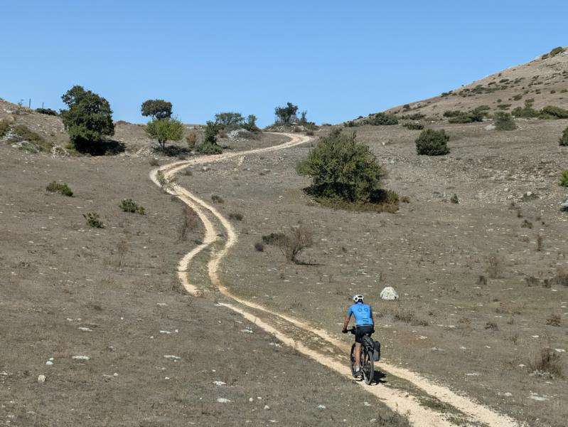
A whole herd of deer barely seems to notice us. Farther down, the brake pads take a serious beating on the descent. We pass a mountain farm; we can hear dogs barking in the distance, but never see them. The route then continues with views of a ridge lined with wind turbines.
And then, at last, the view we’ve been waiting for: Torre Piccolomini, rising above the old town of Pescina. The tower is part of the ruins of Castello Piccolomini. From the chapel below it, Chiesa della Madonna del Carmine, there’s a good view of the ruins. We could push our bikes up there in a few minutes, but after that tough descent, we decide to skip it.
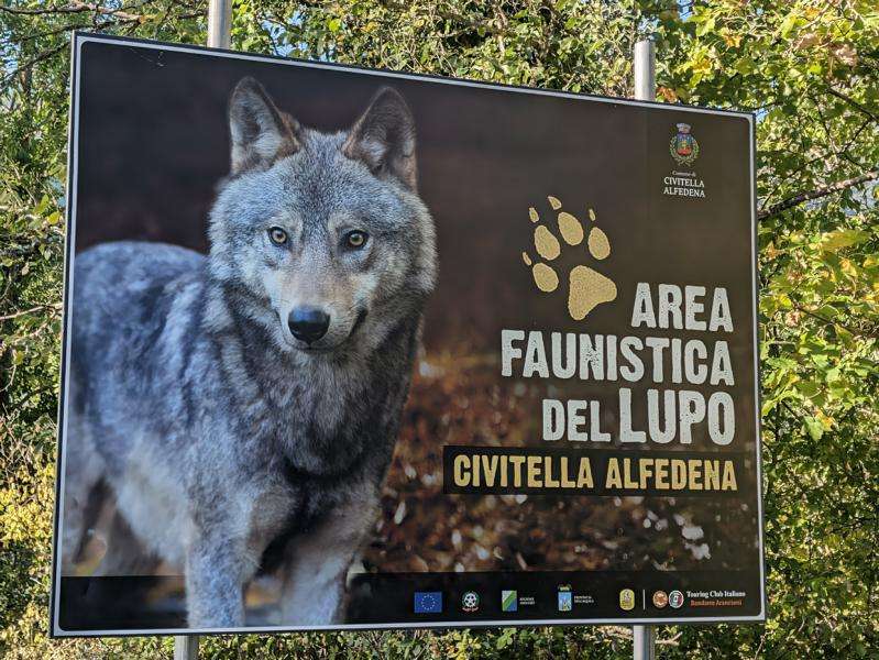
We stop for a break at Bar Centrale on Piazza Mazzarino before tackling the final long climb of the day. There are still around 15 kilometres and 500 metres of climbing between us and our destination.
The route passes right through wolf country. Just before we reach the plateau, a farmer warns us: “State attenti, lassù ci sono i lupi!”—“Be careful, there are wolves up there!” We don’t see any, but the next day Randall, who crossed the plateau a little after us, tells us that a smaller wolf crossed the trail in front of him.
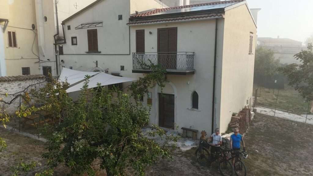
Back on asphalt, we descend to Gagliano Aterno. Our B&B, Casa da Medardo, is tucked away in a quiet spot. We have the whole house to ourselves. Natascia shows us around, and Paolo kindly tells us where we can still get something to eat in town. I hadn’t found anywhere open on My Maps. We can have breakfast there, too, at Circolo ARCI Gallo, just a few hundred metres away.


Day 5: Gagliano Aterno – Sassa Scalo
71 km · 1,600 m elevation gain · Moving time: 7:30 · Total time: 9:50
After breakfast, we set off. Just five kilometres later, we reach Secinaro, our last chance to stock up for the day. At La Botteguccia, Anna Maria’s small and welcoming shop, she makes us delicious pecorino panini. We also pick up some biscuits to snack on along the way.
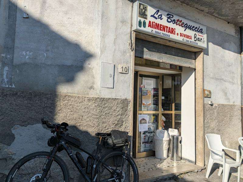
We briefly lose our way in the village, which clings to the hillside. After laboriously climbing the steps, we have to go back down part of the way. Later, I spot on the map that we could have pushed a little farther uphill and taken another path back to the route.
I can’t really recommend the next four kilometres through a small valley. A narrow path winds through rather unremarkable scrub, and there’s quite a bit of pushing. To skip this section, take the road on the left towards Rocca di Mezzo just before the village. After about five kilometres, it rejoins the original route near a small parking area.
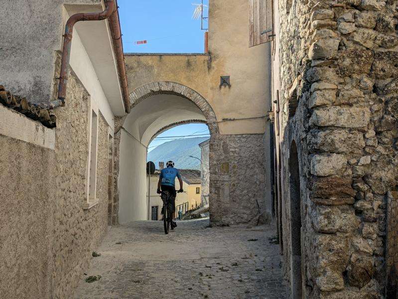
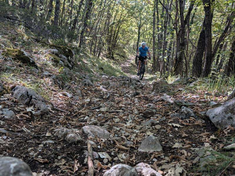
From there, the scenery improves. A hiking trail takes us through rocky, partly wooded terrain. We have to get off and push from time to time over these three kilometres, too. At a derelict former mountain refuge, we join a gravel track. The imposing Sirente massif rises to our left.
We stop briefly at Pagliare di Tione, a small hamlet of stone houses on a high plateau at the edge of the Altopiano delle Rocche, which we are now crossing.
In the past, people came up from the villages in the valley each summer to cultivate the fields and tend their animals. Because the journey to their land was so long, they first built hay and straw sheds. Over time, these gradually became simple homes. The hamlet also has a small church and a large, round water cistern. The Pagliare were gradually abandoned from the 1960s onwards, though some houses have since been restored as summer homes.
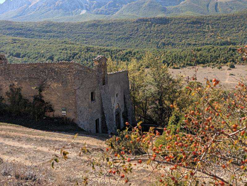
The gravel road to Terranera is a little rough in places. Between Terranera and Rocca di Cambio, the landscape opens out into a broad upland plateau. Meadows and pastures stretch across the karst terrain, framed by the Apennine mountains.
We leave Rocca di Cambio above us to the right and stop for a short break at a campervan site below the village. There’s water here, too—a welcome find, as water is scarce along today’s route.
The road continues gently uphill to a tunnel. It’s well lit and about a kilometre and a half long. Thankfully, there’s very little traffic. When we emerge into daylight on the other side, the Campo Felice ski area lies ahead.
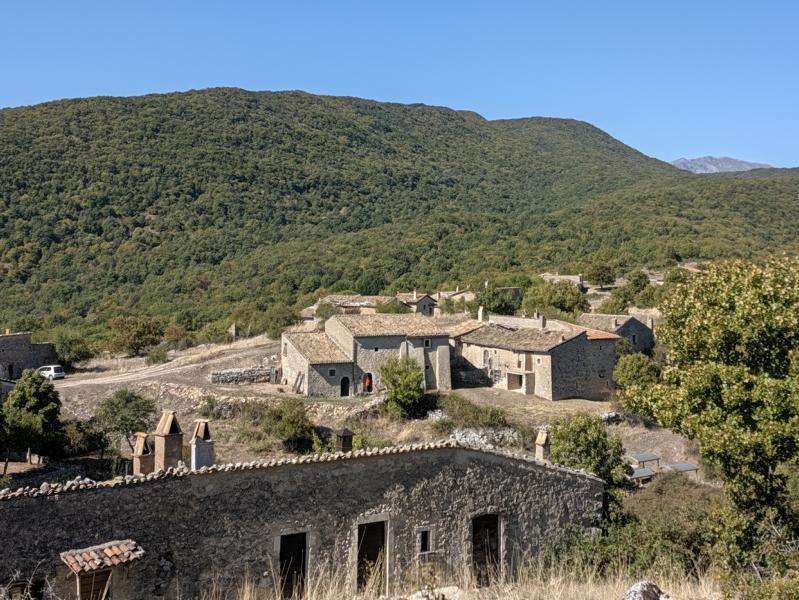
The track across the plateau is a little bumpy now. To be honest, we take the parallel road for one section. Then a gentle climb on a grassy track brings us to the day’s highest point: Valico della Chiesola, at 1,633 metres.
Our route turns left, and almost 1,000 metres of descent lie ahead. We’re a little too quick to celebrate, though. The next 20 kilometres are far from an easy roll downhill. The trail is rough and strewn with loose rocks. From the road underpass at around kilometre 53, I find it almost impossible to ride: the track gets steeper and the deep, loose gravel is made up of large stones—not the fine, smooth kind sometimes called “champagne gravel.” This goes on for about four kilometres, all the way to the village of Santa Croce.
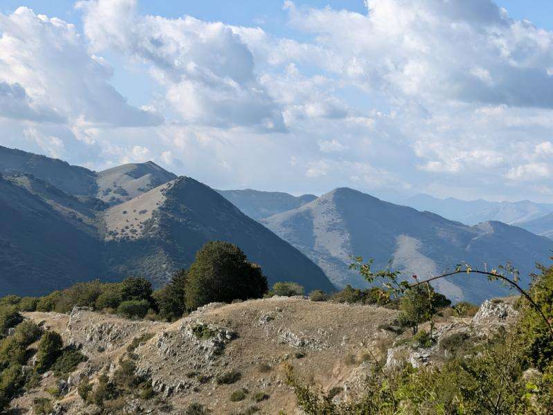
The route then continues off-road, at times rather frustratingly parallel to the motorway. Near Genzano, we turn left and follow asphalt through Sassa to Sassa Scalo, where we left our car.
If you follow our track, don’t let the final loop confuse you. I rode it after taking a wrong turn; there’s no need to repeat my mistake. The route is simpler than that.


Our route planning
My Maps
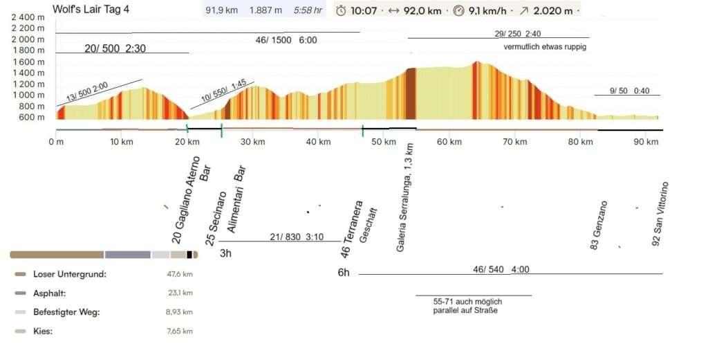
Our planned elevation profiles with details (4 days):
Giorno 1
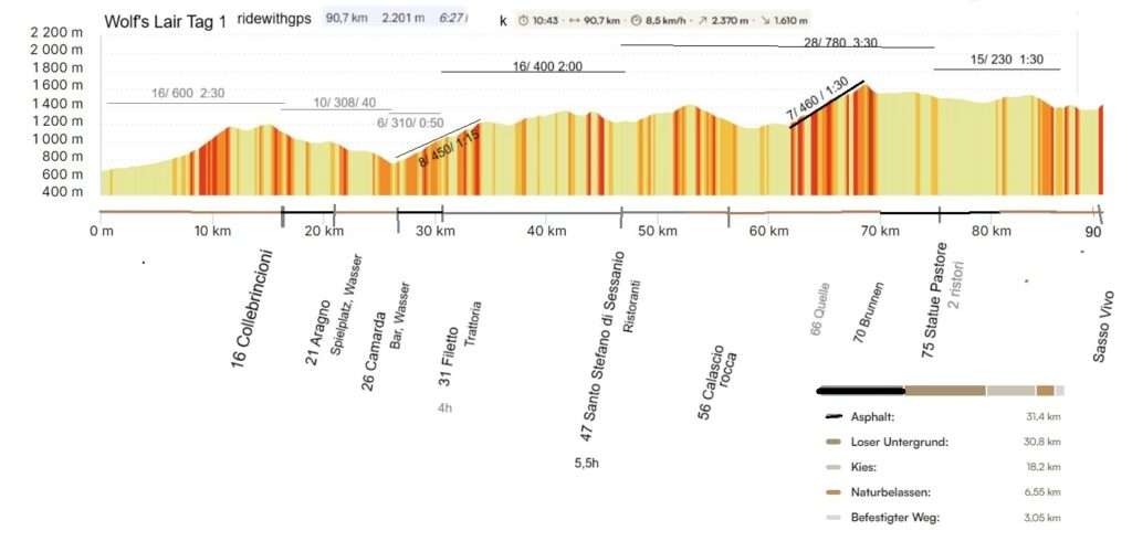
Giorno 2
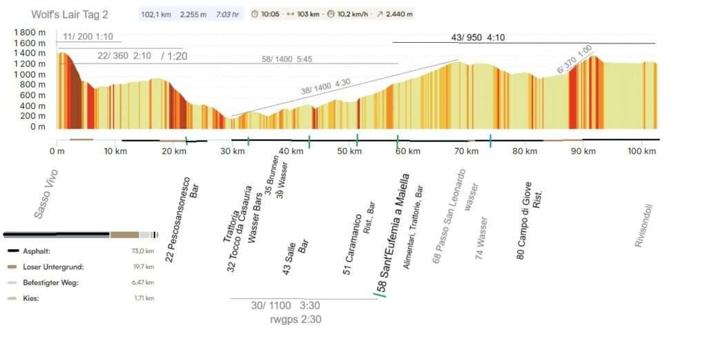
Giorno 3

Giorno 4